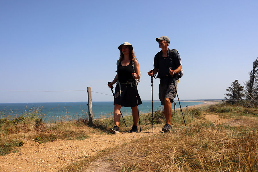
VANDRERUTE Aarslev Engsø rundt (9,5 km)
Aarslev Engsø rimer på både ådal og fugleliv! Den genskabte sø ligger i Brabrand ganske kort fra Aarhus – og rundturen på 9,5 km er barnevognsvenlig
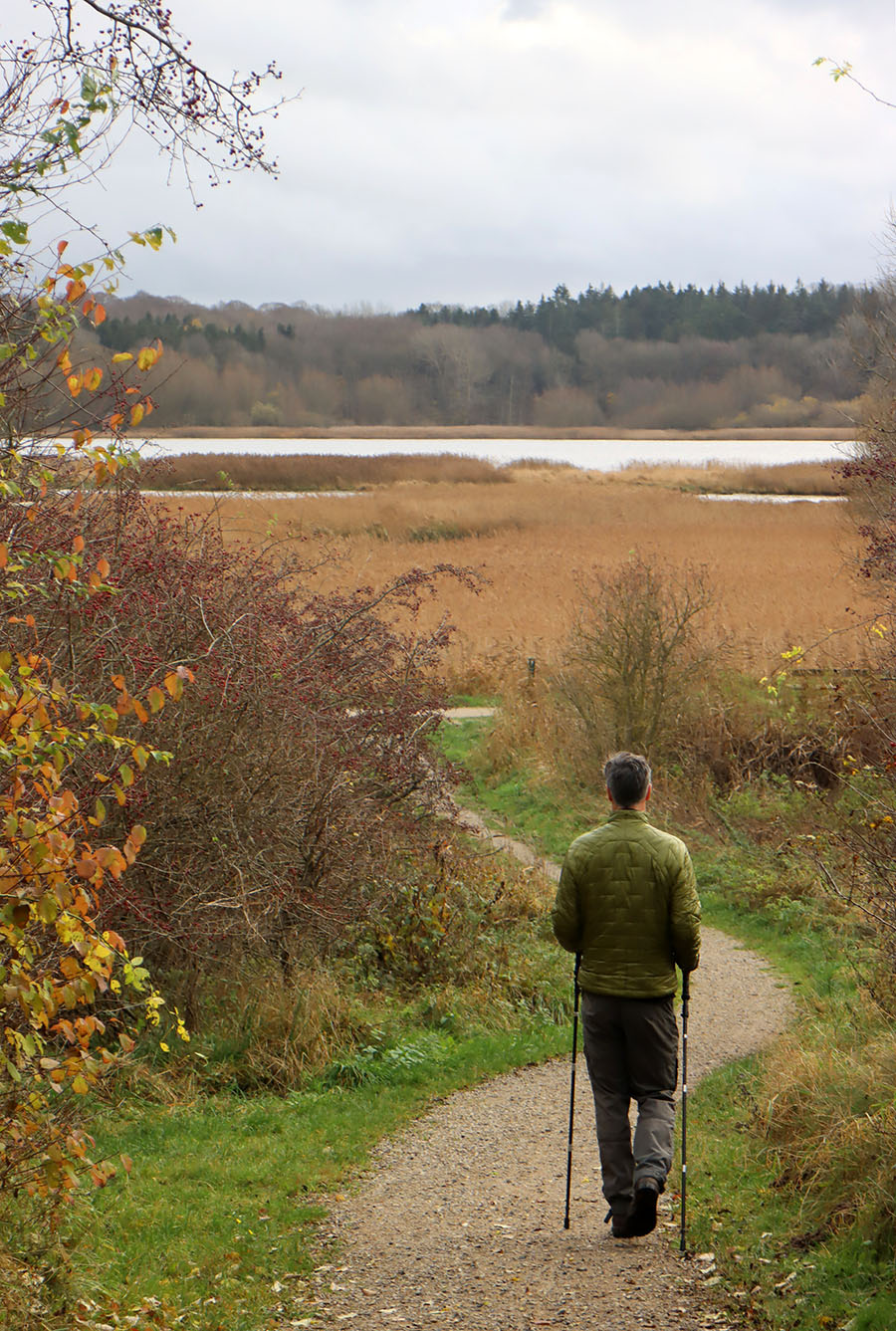
På vej til familiefødselsdag i Aarhus snuppede vi lige en travetur et nyt sted: Rundt om Aarlev Engsø. Den har vi hørt fra nogle af vores læsere – dejligt, når inspirationen går begge veje.

Facts om ruten:
- Distance: 9,5 km rundtur
- Parkering: Der er offentlig P-plads på hjørnet af Byledet og Søskovvej, 8220 Brabrand (og flere andre undervejs)
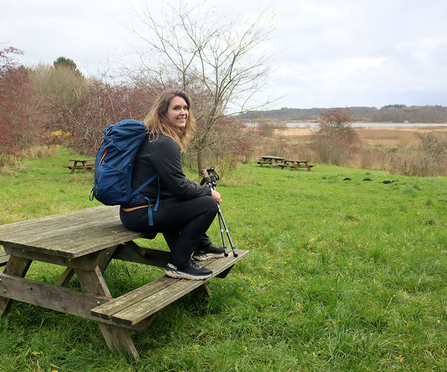
- Barnevogn og hund: Ja
Oplevelser undervejs
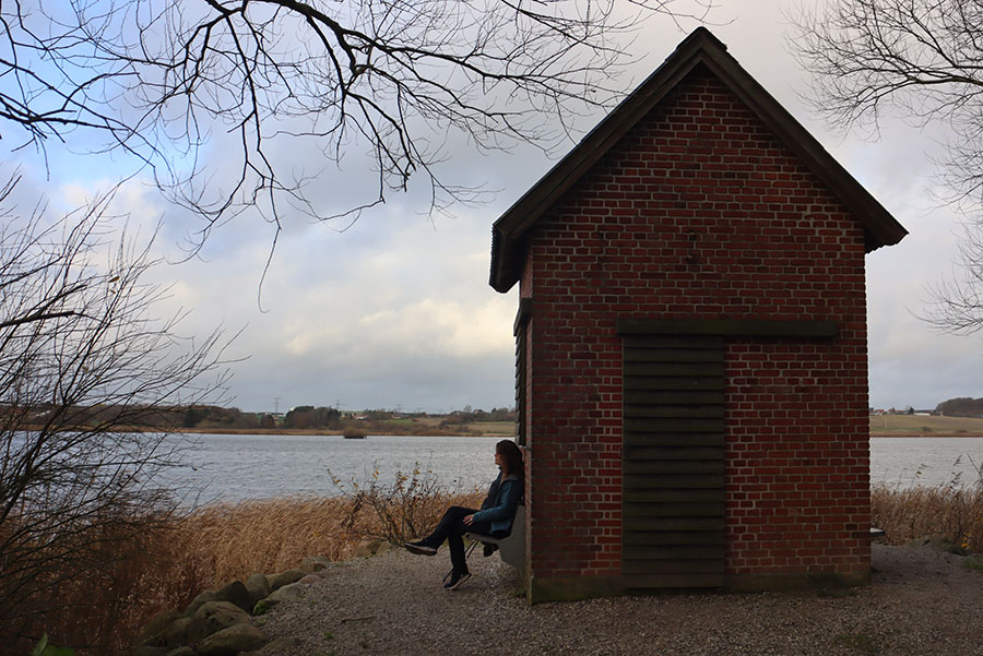
Ruten rundt om Aarslev Engsø er rig på fugleliv og mulighed for at opleve landskabet og fuglene oppefra fugletårnene. Landskabet er et fint tunnel-dal-landskab og en del af Aarhus ådal. Undervejs kommer du forbi den kæmpestore herregård Constantinsborg, der er familien Holck-Povlsens hjem.
Hvad er søens historie?
Området ved Aarslev Engsø har igennem 250 år været afvandet af lodsejerne for at kunne udnytte engene. I 1990’erne besluttede man at give området tilbage til naturen. I marts 2003 gravede man igennem ådiget ved Skibby, og allerede efter 2-3 uger var engene fyldt af vand igen. Aarslev Engsø var genskabt.

Er ruten skiltet?
Selve turen rundt om Aarslev Engsø er ikke skiltet, men det behøves sådan set heller ikke – du kan nemt orientere dig ift. søen hele vejen rundt. Og der er mange skilte, der fortæller dig hvor du er og hvad der er i hvilken retning.

Kan ruten forlænges?
Aarslev Engsø ligge lige op ad Brabrand Sø, så du kan nemt forlænge turen til 16,5 km ved at vandre begge søer. Se kortet længere nede. Der er masser af gode pausesteder undervejs og delvist læ i fugletårnene.

Vil I vandre ruten igen?
Ruten bestod gråvejrsprøven – dvs. den var stadig god en novembergrå, blæsende dag. Vi var noget ærgerlige over den vestlige ende af ruten, hvor larmen fra Østjyske Motorvej skæmmer meget – i hvert fald på en blæsevejrsdag, som den vi vandrede. Bilernes susen er dog ikke nok til at afskrække os en anden gang heller, så er vi i området, kunne vi godt finde på at gentage ruten på en anden årstid.
Kort over vandreruten Aarslev Engsø rundt
Her kan du se et kort over vandreruten Aarslev Engsø rundt. Du kan nemt få det ind på din mobil, så du kan se, hvor du selv er:
- Download den gratis app AllTrails her til apple eller her til android og opret din profil
- Klik på linket her vandreruten Aarslev Engsø rundt – du er den blå prik på kortet.
Hvis du har mere tid og gerne vil forlænge ruten, kan du kombinere turen rundt om Aarslev Engsø med turen rundt om Brabrand Sø. Så får du en rundtur på 16,5 kilometer:
 https://www.friefodspor.dk/wp-content/uploads/2024/09/Lyngstien-birketrae-lyng-blomstrende-vandresti.jpg
601
900
Frie Fodspor
https://www.friefodspor.dk/wp-content/uploads/2020/05/FF-logo-400-x156-_2020.png
Frie Fodspor2024-09-27 20:56:492024-10-25 15:10:13VANDRERUTE Lyngstien langs Kattegat (3 km rundtur)
https://www.friefodspor.dk/wp-content/uploads/2024/09/Lyngstien-birketrae-lyng-blomstrende-vandresti.jpg
601
900
Frie Fodspor
https://www.friefodspor.dk/wp-content/uploads/2020/05/FF-logo-400-x156-_2020.png
Frie Fodspor2024-09-27 20:56:492024-10-25 15:10:13VANDRERUTE Lyngstien langs Kattegat (3 km rundtur) https://www.friefodspor.dk/wp-content/uploads/2024/09/Kvottrupruten-kastbjerg-aadal-vandrerute-mariager-vandrer-betragter-landskab.jpg
628
900
Frie Fodspor
https://www.friefodspor.dk/wp-content/uploads/2020/05/FF-logo-400-x156-_2020.png
Frie Fodspor2024-09-27 20:19:412024-11-15 13:14:29VANDRERUTE Kastbjerg ådal rundt (7 km rundtur)
https://www.friefodspor.dk/wp-content/uploads/2024/09/Kvottrupruten-kastbjerg-aadal-vandrerute-mariager-vandrer-betragter-landskab.jpg
628
900
Frie Fodspor
https://www.friefodspor.dk/wp-content/uploads/2020/05/FF-logo-400-x156-_2020.png
Frie Fodspor2024-09-27 20:19:412024-11-15 13:14:29VANDRERUTE Kastbjerg ådal rundt (7 km rundtur) https://www.friefodspor.dk/wp-content/uploads/2024/09/IMG_1056.jpeg
1512
2016
Frie Fodspor
https://www.friefodspor.dk/wp-content/uploads/2020/05/FF-logo-400-x156-_2020.png
Frie Fodspor2024-09-26 22:26:052024-09-27 14:35:14VANDRERUTE Silkeruten – 12 km rundt om de tusind søers by
https://www.friefodspor.dk/wp-content/uploads/2024/09/IMG_1056.jpeg
1512
2016
Frie Fodspor
https://www.friefodspor.dk/wp-content/uploads/2020/05/FF-logo-400-x156-_2020.png
Frie Fodspor2024-09-26 22:26:052024-09-27 14:35:14VANDRERUTE Silkeruten – 12 km rundt om de tusind søers by https://www.friefodspor.dk/wp-content/uploads/2021/02/danmarkskort-900x900-1.jpg
900
900
Marie
https://www.friefodspor.dk/wp-content/uploads/2020/05/FF-logo-400-x156-_2020.png
Marie2024-07-23 12:03:272024-08-03 06:36:46Frie fodspors vandrekort
https://www.friefodspor.dk/wp-content/uploads/2021/02/danmarkskort-900x900-1.jpg
900
900
Marie
https://www.friefodspor.dk/wp-content/uploads/2020/05/FF-logo-400-x156-_2020.png
Marie2024-07-23 12:03:272024-08-03 06:36:46Frie fodspors vandrekort https://www.friefodspor.dk/wp-content/uploads/2024/07/Frisdal-Valsgaard-Baek-groen-hjerritsdal-moelle-vandreruten.jpg
600
900
Frie Fodspor
https://www.friefodspor.dk/wp-content/uploads/2020/05/FF-logo-400-x156-_2020.png
Frie Fodspor2024-07-20 16:38:492024-09-21 23:56:21VANDRERUTE Frisdalruten langs Valsgård Bæk (2,3 km A til B)
https://www.friefodspor.dk/wp-content/uploads/2024/07/Frisdal-Valsgaard-Baek-groen-hjerritsdal-moelle-vandreruten.jpg
600
900
Frie Fodspor
https://www.friefodspor.dk/wp-content/uploads/2020/05/FF-logo-400-x156-_2020.png
Frie Fodspor2024-07-20 16:38:492024-09-21 23:56:21VANDRERUTE Frisdalruten langs Valsgård Bæk (2,3 km A til B)
 https://www.friefodspor.dk/wp-content/uploads/2024/06/Karen-Blixenruten-rungstedlund-danske-digterruter-vandretur-vandring-vandre-design.jpg
600
900
Frie Fodspor
https://www.friefodspor.dk/wp-content/uploads/2020/05/FF-logo-400-x156-_2020.png
Frie Fodspor2024-06-03 12:36:552024-08-22 08:59:32VANDRERUTE I Karen Blixens fodspor på Blixenruten (16 km rundtur)
https://www.friefodspor.dk/wp-content/uploads/2024/06/Karen-Blixenruten-rungstedlund-danske-digterruter-vandretur-vandring-vandre-design.jpg
600
900
Frie Fodspor
https://www.friefodspor.dk/wp-content/uploads/2020/05/FF-logo-400-x156-_2020.png
Frie Fodspor2024-06-03 12:36:552024-08-22 08:59:32VANDRERUTE I Karen Blixens fodspor på Blixenruten (16 km rundtur) https://www.friefodspor.dk/wp-content/uploads/2024/06/kanalstien-frederik-VII-kanal-logstoer-lendrup-vandrerute.jpg
600
900
Frie Fodspor
https://www.friefodspor.dk/wp-content/uploads/2020/05/FF-logo-400-x156-_2020.png
Frie Fodspor2024-06-01 10:35:542024-08-27 15:26:05VANDRERUTE Rundtur langs Frederik VIIs kanal mellem Løgstør og Lendrup (12 km)
https://www.friefodspor.dk/wp-content/uploads/2024/06/kanalstien-frederik-VII-kanal-logstoer-lendrup-vandrerute.jpg
600
900
Frie Fodspor
https://www.friefodspor.dk/wp-content/uploads/2020/05/FF-logo-400-x156-_2020.png
Frie Fodspor2024-06-01 10:35:542024-08-27 15:26:05VANDRERUTE Rundtur langs Frederik VIIs kanal mellem Løgstør og Lendrup (12 km) https://www.friefodspor.dk/wp-content/uploads/2024/05/vandre-gennem-dyrefolde-indhegninger-kvaeg-heste-tyrefold-hund-i-snor-vandring-graesning-regler.jpg
750
1125
Frie Fodspor
https://www.friefodspor.dk/wp-content/uploads/2020/05/FF-logo-400-x156-_2020.png
Frie Fodspor2024-05-31 07:38:382024-08-27 15:30:37GUIDE Dyr på stien – værd at vide om at vandre gennem dyrefolde
https://www.friefodspor.dk/wp-content/uploads/2024/05/vandre-gennem-dyrefolde-indhegninger-kvaeg-heste-tyrefold-hund-i-snor-vandring-graesning-regler.jpg
750
1125
Frie Fodspor
https://www.friefodspor.dk/wp-content/uploads/2020/05/FF-logo-400-x156-_2020.png
Frie Fodspor2024-05-31 07:38:382024-08-27 15:30:37GUIDE Dyr på stien – værd at vide om at vandre gennem dyrefolde https://www.friefodspor.dk/wp-content/uploads/2024/05/Panoramaruten-mariagerfjord.bramslev-bakker-viping-pod-scaled.jpg
1707
2560
Frie Fodspor
https://www.friefodspor.dk/wp-content/uploads/2020/05/FF-logo-400-x156-_2020.png
Frie Fodspor2024-05-01 20:25:002024-06-03 11:10:11GUIDE Vandreferie i Himmerland
https://www.friefodspor.dk/wp-content/uploads/2024/05/Panoramaruten-mariagerfjord.bramslev-bakker-viping-pod-scaled.jpg
1707
2560
Frie Fodspor
https://www.friefodspor.dk/wp-content/uploads/2020/05/FF-logo-400-x156-_2020.png
Frie Fodspor2024-05-01 20:25:002024-06-03 11:10:11GUIDE Vandreferie i Himmerland https://www.friefodspor.dk/wp-content/uploads/2024/04/fyrkatstien-vandretur-vandrerute-hobro-vikingeborgen-fyrkat-ringborg-unesco-verdensarv-frie-fodspor-regnvejr.jpg
675
900
Frie Fodspor
https://www.friefodspor.dk/wp-content/uploads/2020/05/FF-logo-400-x156-_2020.png
Frie Fodspor2024-04-30 07:32:422024-06-01 12:19:11VANDRERUTE Fyrkatstien – i vikingernes fodspor (6 km rundtur)
https://www.friefodspor.dk/wp-content/uploads/2024/04/fyrkatstien-vandretur-vandrerute-hobro-vikingeborgen-fyrkat-ringborg-unesco-verdensarv-frie-fodspor-regnvejr.jpg
675
900
Frie Fodspor
https://www.friefodspor.dk/wp-content/uploads/2020/05/FF-logo-400-x156-_2020.png
Frie Fodspor2024-04-30 07:32:422024-06-01 12:19:11VANDRERUTE Fyrkatstien – i vikingernes fodspor (6 km rundtur) https://www.friefodspor.dk/wp-content/uploads/2024/04/Laaenhusruten-vandrerute-mariagerfjord-naturpleje-graessende-kvaeg-1.jpg
711
900
Frie Fodspor
https://www.friefodspor.dk/wp-content/uploads/2020/05/FF-logo-400-x156-_2020.png
Frie Fodspor2024-04-13 23:48:212024-10-08 10:34:10VANDRERUTE Låenhusruten ved Mariager Fjord – Panoramarutens ukendte tvilling (5 km rundtur)
https://www.friefodspor.dk/wp-content/uploads/2024/04/Laaenhusruten-vandrerute-mariagerfjord-naturpleje-graessende-kvaeg-1.jpg
711
900
Frie Fodspor
https://www.friefodspor.dk/wp-content/uploads/2020/05/FF-logo-400-x156-_2020.png
Frie Fodspor2024-04-13 23:48:212024-10-08 10:34:10VANDRERUTE Låenhusruten ved Mariager Fjord – Panoramarutens ukendte tvilling (5 km rundtur) https://www.friefodspor.dk/wp-content/uploads/2024/04/Til-fods-paa-Bornholm900.png
601
900
Frie Fodspor
https://www.friefodspor.dk/wp-content/uploads/2020/05/FF-logo-400-x156-_2020.png
Frie Fodspor2024-04-05 16:57:082024-12-18 11:07:34BOG Til fods på Bornholm – den usandsynlige historie om vores første bog
https://www.friefodspor.dk/wp-content/uploads/2024/04/Til-fods-paa-Bornholm900.png
601
900
Frie Fodspor
https://www.friefodspor.dk/wp-content/uploads/2020/05/FF-logo-400-x156-_2020.png
Frie Fodspor2024-04-05 16:57:082024-12-18 11:07:34BOG Til fods på Bornholm – den usandsynlige historie om vores første bog
 https://www.friefodspor.dk/wp-content/uploads/2023/09/Svartingedalen-jaettebolden-vandrerute-bornholm-spraekkedal.jpg
672
900
Frie Fodspor
https://www.friefodspor.dk/wp-content/uploads/2020/05/FF-logo-400-x156-_2020.png
Frie Fodspor2023-09-21 19:01:302024-11-29 11:36:17VANDRERUTE Svartingedalen (3 km A til B)
https://www.friefodspor.dk/wp-content/uploads/2023/09/Svartingedalen-jaettebolden-vandrerute-bornholm-spraekkedal.jpg
672
900
Frie Fodspor
https://www.friefodspor.dk/wp-content/uploads/2020/05/FF-logo-400-x156-_2020.png
Frie Fodspor2023-09-21 19:01:302024-11-29 11:36:17VANDRERUTE Svartingedalen (3 km A til B)

 https://www.friefodspor.dk/wp-content/uploads/2020/09/ekkodalen-hoejlyngsstien-vandrerute-paa-bornholm.jpg
750
1500
Marie
https://www.friefodspor.dk/wp-content/uploads/2020/05/FF-logo-400-x156-_2020.png
Marie2023-09-16 21:34:062024-06-09 15:04:43GUIDE Højlyngsstien 67,5 km tværs over Bornholm
https://www.friefodspor.dk/wp-content/uploads/2020/09/ekkodalen-hoejlyngsstien-vandrerute-paa-bornholm.jpg
750
1500
Marie
https://www.friefodspor.dk/wp-content/uploads/2020/05/FF-logo-400-x156-_2020.png
Marie2023-09-16 21:34:062024-06-09 15:04:43GUIDE Højlyngsstien 67,5 km tværs over Bornholm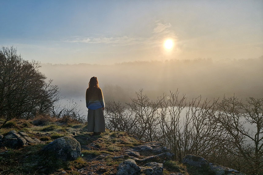 https://www.friefodspor.dk/wp-content/uploads/2023/08/spellinge-mose-storeborg-vandring-paa-bornholm-roe-vandrerute-mosekonens-bryg.jpg
572
858
Frie Fodspor
https://www.friefodspor.dk/wp-content/uploads/2020/05/FF-logo-400-x156-_2020.png
Frie Fodspor2023-08-30 18:02:552024-03-20 19:46:20VANDRERUTE Døndalen – mosekonens bryg og Bornholms vilde vandfald (13 km rundtur)
https://www.friefodspor.dk/wp-content/uploads/2023/08/spellinge-mose-storeborg-vandring-paa-bornholm-roe-vandrerute-mosekonens-bryg.jpg
572
858
Frie Fodspor
https://www.friefodspor.dk/wp-content/uploads/2020/05/FF-logo-400-x156-_2020.png
Frie Fodspor2023-08-30 18:02:552024-03-20 19:46:20VANDRERUTE Døndalen – mosekonens bryg og Bornholms vilde vandfald (13 km rundtur) https://www.friefodspor.dk/wp-content/uploads/2023/08/vandrerute-gudhjem-rundt-norresan-oluf-hoests-fodspor-bokul-noerresand-solnedgang.jpg
600
900
Frie Fodspor
https://www.friefodspor.dk/wp-content/uploads/2020/05/FF-logo-400-x156-_2020.png
Frie Fodspor2023-08-30 07:43:362024-01-16 23:10:35VANDRERUTE Gudhjems hemmelige bagland – i Oluf Høsts fodspor (13 km rundtur)
https://www.friefodspor.dk/wp-content/uploads/2023/08/vandrerute-gudhjem-rundt-norresan-oluf-hoests-fodspor-bokul-noerresand-solnedgang.jpg
600
900
Frie Fodspor
https://www.friefodspor.dk/wp-content/uploads/2020/05/FF-logo-400-x156-_2020.png
Frie Fodspor2023-08-30 07:43:362024-01-16 23:10:35VANDRERUTE Gudhjems hemmelige bagland – i Oluf Høsts fodspor (13 km rundtur) https://www.friefodspor.dk/wp-content/uploads/2022/05/FAC746F3-2D9A-436E-BC5E-034CAFCC28DA.jpeg
1536
2048
Marie
https://www.friefodspor.dk/wp-content/uploads/2020/05/FF-logo-400-x156-_2020.png
Marie2023-08-29 18:06:272024-02-26 09:14:05VANDRERUTE Odsherreds magiske landskaber (26 km rundtur, som nemt kan deles op)
https://www.friefodspor.dk/wp-content/uploads/2022/05/FAC746F3-2D9A-436E-BC5E-034CAFCC28DA.jpeg
1536
2048
Marie
https://www.friefodspor.dk/wp-content/uploads/2020/05/FF-logo-400-x156-_2020.png
Marie2023-08-29 18:06:272024-02-26 09:14:05VANDRERUTE Odsherreds magiske landskaber (26 km rundtur, som nemt kan deles op) https://www.friefodspor.dk/wp-content/uploads/2017/06/kyst-til-kyst-stien-vejle-blaavandshuk-frie-fodspor.jpg
600
900
Frie Fodspor
https://www.friefodspor.dk/wp-content/uploads/2020/05/FF-logo-400-x156-_2020.png
Frie Fodspor2023-07-17 13:53:512024-11-29 11:29:18GUIDE Kyst til Kyst Stien fra Vejle til Blåvandshuk (136 km A til B)
https://www.friefodspor.dk/wp-content/uploads/2017/06/kyst-til-kyst-stien-vejle-blaavandshuk-frie-fodspor.jpg
600
900
Frie Fodspor
https://www.friefodspor.dk/wp-content/uploads/2020/05/FF-logo-400-x156-_2020.png
Frie Fodspor2023-07-17 13:53:512024-11-29 11:29:18GUIDE Kyst til Kyst Stien fra Vejle til Blåvandshuk (136 km A til B)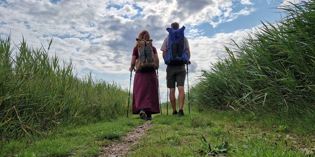 https://www.friefodspor.dk/wp-content/uploads/2023/07/hvor-kan-man-overnatte-paa-kyst-til-kyst-stien.jpg
750
1500
Frie Fodspor
https://www.friefodspor.dk/wp-content/uploads/2020/05/FF-logo-400-x156-_2020.png
Frie Fodspor2023-07-16 19:12:472024-11-29 11:30:26ETAPER Her kan du overnatte indendørs på Kyst til Kyst Stien (7 dage)
https://www.friefodspor.dk/wp-content/uploads/2023/07/hvor-kan-man-overnatte-paa-kyst-til-kyst-stien.jpg
750
1500
Frie Fodspor
https://www.friefodspor.dk/wp-content/uploads/2020/05/FF-logo-400-x156-_2020.png
Frie Fodspor2023-07-16 19:12:472024-11-29 11:30:26ETAPER Her kan du overnatte indendørs på Kyst til Kyst Stien (7 dage) https://www.friefodspor.dk/wp-content/uploads/2023/05/Trampestien-stevns-klint-udsigt-havkajak.jpg
720
900
Frie Fodspor
https://www.friefodspor.dk/wp-content/uploads/2020/05/FF-logo-400-x156-_2020.png
Frie Fodspor2023-05-21 16:44:032023-08-29 18:27:03VANDRERUTE Trampestien Stevns Klint (22 km A til B)
https://www.friefodspor.dk/wp-content/uploads/2023/05/Trampestien-stevns-klint-udsigt-havkajak.jpg
720
900
Frie Fodspor
https://www.friefodspor.dk/wp-content/uploads/2020/05/FF-logo-400-x156-_2020.png
Frie Fodspor2023-05-21 16:44:032023-08-29 18:27:03VANDRERUTE Trampestien Stevns Klint (22 km A til B) https://www.friefodspor.dk/wp-content/uploads/2023/05/hverrestrup-bakker-blaest-vandrerute-himmerland-bakker-sol.jpg
600
900
Frie Fodspor
https://www.friefodspor.dk/wp-content/uploads/2020/05/FF-logo-400-x156-_2020.png
Frie Fodspor2023-05-21 16:02:502024-06-08 09:07:57VANDRERUTE Hverrestrup bakker i Himmerland (2,3 km rundtur)
https://www.friefodspor.dk/wp-content/uploads/2023/05/hverrestrup-bakker-blaest-vandrerute-himmerland-bakker-sol.jpg
600
900
Frie Fodspor
https://www.friefodspor.dk/wp-content/uploads/2020/05/FF-logo-400-x156-_2020.png
Frie Fodspor2023-05-21 16:02:502024-06-08 09:07:57VANDRERUTE Hverrestrup bakker i Himmerland (2,3 km rundtur) https://www.friefodspor.dk/wp-content/uploads/2023/05/lillebaeltstien-aa-strand-loegismose-strand-nabben-dambo-strand.jpg
600
900
Frie Fodspor
https://www.friefodspor.dk/wp-content/uploads/2020/05/FF-logo-400-x156-_2020.png
Frie Fodspor2023-05-02 12:49:022025-01-02 17:10:00VANDRERUTE Den oversete Lillebæltstien (11+9 km A til B)
https://www.friefodspor.dk/wp-content/uploads/2023/05/lillebaeltstien-aa-strand-loegismose-strand-nabben-dambo-strand.jpg
600
900
Frie Fodspor
https://www.friefodspor.dk/wp-content/uploads/2020/05/FF-logo-400-x156-_2020.png
Frie Fodspor2023-05-02 12:49:022025-01-02 17:10:00VANDRERUTE Den oversete Lillebæltstien (11+9 km A til B)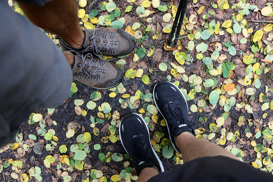 https://www.friefodspor.dk/wp-content/uploads/2023/04/pakkeliste-haervejen-sommer-maend-kvinder-telt.jpg
601
900
Frie Fodspor
https://www.friefodspor.dk/wp-content/uploads/2020/05/FF-logo-400-x156-_2020.png
Frie Fodspor2023-04-18 06:31:182023-08-29 18:27:08PAKKELISTE til Hærvejen: Lykken er at vandre let
https://www.friefodspor.dk/wp-content/uploads/2023/04/pakkeliste-haervejen-sommer-maend-kvinder-telt.jpg
601
900
Frie Fodspor
https://www.friefodspor.dk/wp-content/uploads/2020/05/FF-logo-400-x156-_2020.png
Frie Fodspor2023-04-18 06:31:182023-08-29 18:27:08PAKKELISTE til Hærvejen: Lykken er at vandre let
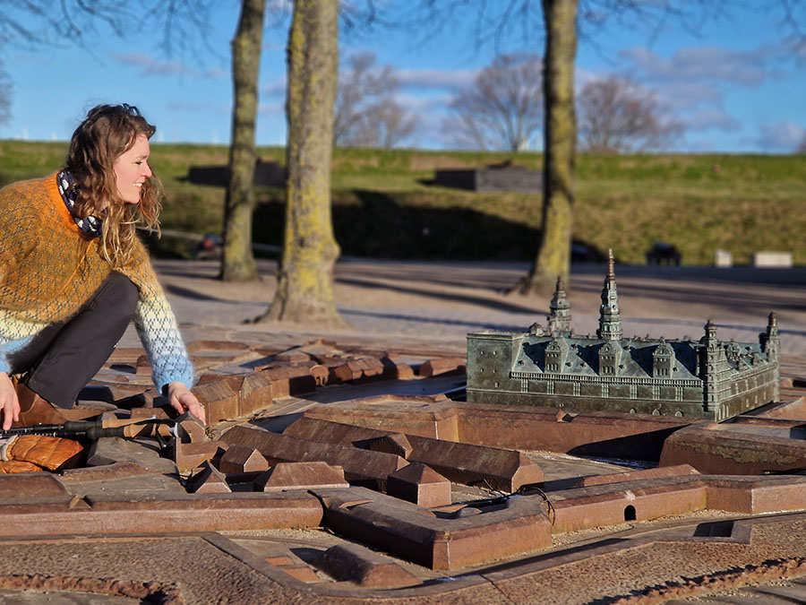 https://www.friefodspor.dk/wp-content/uploads/2023/03/miniature-kronborg-skulptur-vandrerute-helsingoer-rundt.jpg
675
900
Marie
https://www.friefodspor.dk/wp-content/uploads/2020/05/FF-logo-400-x156-_2020.png
Marie2023-03-26 18:14:352023-08-29 18:27:12VANDRERUTE Helsingør rundt – alt det vi elsker! (7 km rundtur)
https://www.friefodspor.dk/wp-content/uploads/2023/03/miniature-kronborg-skulptur-vandrerute-helsingoer-rundt.jpg
675
900
Marie
https://www.friefodspor.dk/wp-content/uploads/2020/05/FF-logo-400-x156-_2020.png
Marie2023-03-26 18:14:352023-08-29 18:27:12VANDRERUTE Helsingør rundt – alt det vi elsker! (7 km rundtur)
 https://www.friefodspor.dk/wp-content/uploads/2023/03/vandrerute-paradisbakkerne-stier-rundture-vandreferie-paa-bornholm.jpg
938
900
Marie
https://www.friefodspor.dk/wp-content/uploads/2020/05/FF-logo-400-x156-_2020.png
Marie2023-03-24 20:33:562024-11-29 11:40:13VANDRERUTER Paradisbakkerne på Bornholm (rundture på 3 km, 6,3 km og 6,5 km)
https://www.friefodspor.dk/wp-content/uploads/2023/03/vandrerute-paradisbakkerne-stier-rundture-vandreferie-paa-bornholm.jpg
938
900
Marie
https://www.friefodspor.dk/wp-content/uploads/2020/05/FF-logo-400-x156-_2020.png
Marie2023-03-24 20:33:562024-11-29 11:40:13VANDRERUTER Paradisbakkerne på Bornholm (rundture på 3 km, 6,3 km og 6,5 km) https://www.friefodspor.dk/wp-content/uploads/2023/03/udsigt-til-hammershus-og-opalsoeen-vandring-paa-bornholm-vandreferie-vandrerute-hammerknuden-rundt-skiltet.jpg
1117
1500
Marie
https://www.friefodspor.dk/wp-content/uploads/2020/05/FF-logo-400-x156-_2020.png
Marie2023-03-24 20:03:352024-11-29 11:41:04VANDRERUTE Hammerknuden rundt på Bornholm (7 km)
https://www.friefodspor.dk/wp-content/uploads/2023/03/udsigt-til-hammershus-og-opalsoeen-vandring-paa-bornholm-vandreferie-vandrerute-hammerknuden-rundt-skiltet.jpg
1117
1500
Marie
https://www.friefodspor.dk/wp-content/uploads/2020/05/FF-logo-400-x156-_2020.png
Marie2023-03-24 20:03:352024-11-29 11:41:04VANDRERUTE Hammerknuden rundt på Bornholm (7 km) https://www.friefodspor.dk/wp-content/uploads/2023/02/20230213_164029b-scaled.jpg
1707
2560
Marie
https://www.friefodspor.dk/wp-content/uploads/2020/05/FF-logo-400-x156-_2020.png
Marie2023-02-22 20:59:032024-06-09 15:10:19VANDRERUTE Hjertestien ved Ertebølle plus en perle (8,5 km rundtur)
https://www.friefodspor.dk/wp-content/uploads/2023/02/20230213_164029b-scaled.jpg
1707
2560
Marie
https://www.friefodspor.dk/wp-content/uploads/2020/05/FF-logo-400-x156-_2020.png
Marie2023-02-22 20:59:032024-06-09 15:10:19VANDRERUTE Hjertestien ved Ertebølle plus en perle (8,5 km rundtur) https://www.friefodspor.dk/wp-content/uploads/2023/02/bulbjerg-vandrerute-kvalitetssti-rundtur-vesterhavet-trapper.jpg
600
900
Marie
https://www.friefodspor.dk/wp-content/uploads/2020/05/FF-logo-400-x156-_2020.png
Marie2023-02-22 20:58:182023-08-29 18:27:22VANDRERUTE Bulbjerg – bragende smukke Danmark (18 km rundtur)
https://www.friefodspor.dk/wp-content/uploads/2023/02/bulbjerg-vandrerute-kvalitetssti-rundtur-vesterhavet-trapper.jpg
600
900
Marie
https://www.friefodspor.dk/wp-content/uploads/2020/05/FF-logo-400-x156-_2020.png
Marie2023-02-22 20:58:182023-08-29 18:27:22VANDRERUTE Bulbjerg – bragende smukke Danmark (18 km rundtur) https://www.friefodspor.dk/wp-content/uploads/2023/02/mariager-rundt-vandrerute-alstrup-krat-oksendalen-oxendalen.jpg
600
900
Marie
https://www.friefodspor.dk/wp-content/uploads/2020/05/FF-logo-400-x156-_2020.png
Marie2023-02-22 17:42:552024-09-13 21:59:05VANDRERUTE Mariager Ruten (12,3 km Mariager rundt)
https://www.friefodspor.dk/wp-content/uploads/2023/02/mariager-rundt-vandrerute-alstrup-krat-oksendalen-oxendalen.jpg
600
900
Marie
https://www.friefodspor.dk/wp-content/uploads/2020/05/FF-logo-400-x156-_2020.png
Marie2023-02-22 17:42:552024-09-13 21:59:05VANDRERUTE Mariager Ruten (12,3 km Mariager rundt) https://www.friefodspor.dk/wp-content/uploads/2023/02/Er-kalkkaminoen-godt-skiltet.jpg
600
900
Marie
https://www.friefodspor.dk/wp-content/uploads/2020/05/FF-logo-400-x156-_2020.png
Marie2023-02-15 22:27:312024-11-15 09:40:41VANDRERUTE Kalk Kaminoen (29 km A til B)
https://www.friefodspor.dk/wp-content/uploads/2023/02/Er-kalkkaminoen-godt-skiltet.jpg
600
900
Marie
https://www.friefodspor.dk/wp-content/uploads/2020/05/FF-logo-400-x156-_2020.png
Marie2023-02-15 22:27:312024-11-15 09:40:41VANDRERUTE Kalk Kaminoen (29 km A til B)

 https://www.friefodspor.dk/wp-content/uploads/2022/05/Haervejen-svinklovene-vesterhavet-vandring-vandretur-900.jpg
600
900
Marie
https://www.friefodspor.dk/wp-content/uploads/2020/05/FF-logo-400-x156-_2020.png
Marie2023-02-15 14:12:042024-10-22 11:28:32GUIDE Hærvejen – alle de tips, vi selv ledte efter (645 km A til B)
https://www.friefodspor.dk/wp-content/uploads/2022/05/Haervejen-svinklovene-vesterhavet-vandring-vandretur-900.jpg
600
900
Marie
https://www.friefodspor.dk/wp-content/uploads/2020/05/FF-logo-400-x156-_2020.png
Marie2023-02-15 14:12:042024-10-22 11:28:32GUIDE Hærvejen – alle de tips, vi selv ledte efter (645 km A til B) https://www.friefodspor.dk/wp-content/uploads/2022/05/Haervejen-skaerbaek-plantage-ulve-vandring-vandretur.jpg
600
900
Marie
https://www.friefodspor.dk/wp-content/uploads/2020/05/FF-logo-400-x156-_2020.png
Marie2023-02-14 14:22:292023-08-29 18:27:33GUIDE Hvor lang tid tager det at vandre Hærvejen – og hvor mange kilometer kan man gå om dagen?
https://www.friefodspor.dk/wp-content/uploads/2022/05/Haervejen-skaerbaek-plantage-ulve-vandring-vandretur.jpg
600
900
Marie
https://www.friefodspor.dk/wp-content/uploads/2020/05/FF-logo-400-x156-_2020.png
Marie2023-02-14 14:22:292023-08-29 18:27:33GUIDE Hvor lang tid tager det at vandre Hærvejen – og hvor mange kilometer kan man gå om dagen? https://www.friefodspor.dk/wp-content/uploads/2023/02/kysten-ved-erteboelle-skiltede-vandreruter-fiskerhytter-solnedgang-ved-limfjorden.jpg
600
900
Marie
https://www.friefodspor.dk/wp-content/uploads/2020/05/FF-logo-400-x156-_2020.png
Marie2023-01-15 22:21:422024-06-01 12:22:15VANDRERUTE Ertebøllestien (10 km rundtur)
https://www.friefodspor.dk/wp-content/uploads/2023/02/kysten-ved-erteboelle-skiltede-vandreruter-fiskerhytter-solnedgang-ved-limfjorden.jpg
600
900
Marie
https://www.friefodspor.dk/wp-content/uploads/2020/05/FF-logo-400-x156-_2020.png
Marie2023-01-15 22:21:422024-06-01 12:22:15VANDRERUTE Ertebøllestien (10 km rundtur) https://www.friefodspor.dk/wp-content/uploads/2023/01/hvad-koster-det-at-vandre-haervejen-regnbuen-ender.jpg
601
900
Marie
https://www.friefodspor.dk/wp-content/uploads/2020/05/FF-logo-400-x156-_2020.png
Marie2023-01-14 16:24:432024-07-02 21:10:19GUIDE Hvad koster det at vandre Hærvejen?
https://www.friefodspor.dk/wp-content/uploads/2023/01/hvad-koster-det-at-vandre-haervejen-regnbuen-ender.jpg
601
900
Marie
https://www.friefodspor.dk/wp-content/uploads/2020/05/FF-logo-400-x156-_2020.png
Marie2023-01-14 16:24:432024-07-02 21:10:19GUIDE Hvad koster det at vandre Hærvejen?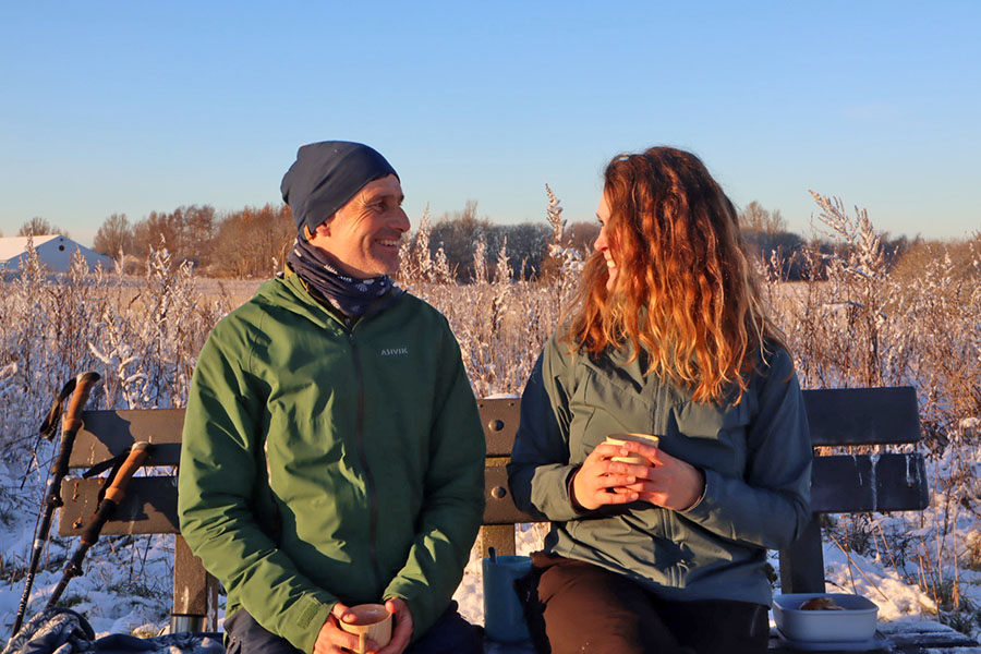 https://www.friefodspor.dk/wp-content/uploads/2022/12/vandrerute-vandretur-humlebaek-frie-fodspor-vandre-om-vinteren.jpg
600
900
Marie
https://www.friefodspor.dk/wp-content/uploads/2020/05/FF-logo-400-x156-_2020.png
Marie2022-12-29 23:01:242024-06-08 08:59:34VANDRERUTE Humlebæk rundt – alt det bedste inklusiv Aarstidernes café og gårdbutik på Krogerup (12 km)
https://www.friefodspor.dk/wp-content/uploads/2022/12/vandrerute-vandretur-humlebaek-frie-fodspor-vandre-om-vinteren.jpg
600
900
Marie
https://www.friefodspor.dk/wp-content/uploads/2020/05/FF-logo-400-x156-_2020.png
Marie2022-12-29 23:01:242024-06-08 08:59:34VANDRERUTE Humlebæk rundt – alt det bedste inklusiv Aarstidernes café og gårdbutik på Krogerup (12 km) https://www.friefodspor.dk/wp-content/uploads/2022/11/vesterhavet-udsigt-over-boegsted-rende-vandrerute-god-sti-i-nationalpark-thy.jpg
983
1500
Marie
https://www.friefodspor.dk/wp-content/uploads/2020/05/FF-logo-400-x156-_2020.png
Marie2022-11-26 21:28:322024-02-15 16:16:06VANDRERUTE På eventyr i Bøgsted Rende – Nationalpark Thy (2,8 km rundtur)
https://www.friefodspor.dk/wp-content/uploads/2022/11/vesterhavet-udsigt-over-boegsted-rende-vandrerute-god-sti-i-nationalpark-thy.jpg
983
1500
Marie
https://www.friefodspor.dk/wp-content/uploads/2020/05/FF-logo-400-x156-_2020.png
Marie2022-11-26 21:28:322024-02-15 16:16:06VANDRERUTE På eventyr i Bøgsted Rende – Nationalpark Thy (2,8 km rundtur) https://www.friefodspor.dk/wp-content/uploads/2022/11/vandrerute-nationalpark-thy-kan-man-komme-op-i-lodbjerg-fyr-solopgang.jpg
675
900
Marie
https://www.friefodspor.dk/wp-content/uploads/2020/05/FF-logo-400-x156-_2020.png
Marie2022-11-26 19:51:412023-08-29 18:27:43GUIDE Derfor starter vandreferien i Nationalpark Thy på toppen af Lodbjerg Fyr!
https://www.friefodspor.dk/wp-content/uploads/2022/11/vandrerute-nationalpark-thy-kan-man-komme-op-i-lodbjerg-fyr-solopgang.jpg
675
900
Marie
https://www.friefodspor.dk/wp-content/uploads/2020/05/FF-logo-400-x156-_2020.png
Marie2022-11-26 19:51:412023-08-29 18:27:43GUIDE Derfor starter vandreferien i Nationalpark Thy på toppen af Lodbjerg Fyr! https://www.friefodspor.dk/wp-content/uploads/2022/11/vandrerute-nationalpark-thy-lodbjerg-fyr-morgenlys-lange-skygger.jpg
601
900
Marie
https://www.friefodspor.dk/wp-content/uploads/2020/05/FF-logo-400-x156-_2020.png
Marie2022-11-26 17:04:352023-08-29 18:27:45VANDRERUTE Magisk vandring i Nationalpark Thy (20 km rundtur)
https://www.friefodspor.dk/wp-content/uploads/2022/11/vandrerute-nationalpark-thy-lodbjerg-fyr-morgenlys-lange-skygger.jpg
601
900
Marie
https://www.friefodspor.dk/wp-content/uploads/2020/05/FF-logo-400-x156-_2020.png
Marie2022-11-26 17:04:352023-08-29 18:27:45VANDRERUTE Magisk vandring i Nationalpark Thy (20 km rundtur)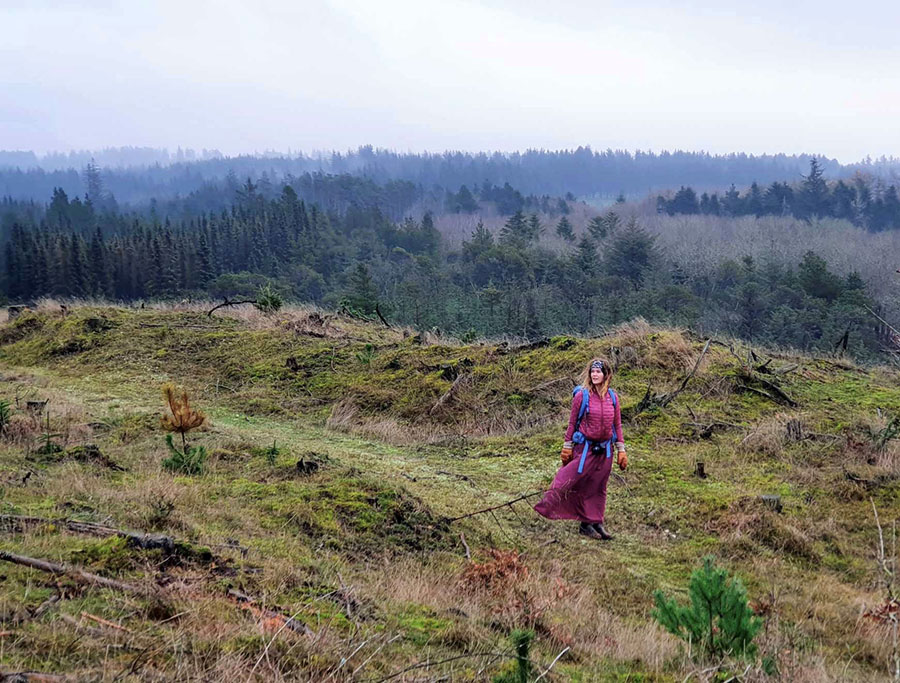 https://www.friefodspor.dk/wp-content/uploads/2022/11/isbjergruten-nationalpark-thy-vandrerute-rundtur-vandring-udsigt-klitlandskab.jpg
683
900
Marie
https://www.friefodspor.dk/wp-content/uploads/2020/05/FF-logo-400-x156-_2020.png
Marie2022-11-25 17:08:012023-08-29 18:27:47VANDRERUTE Isbjergruten Nationalpark Thy (2,8 km rundtur)
https://www.friefodspor.dk/wp-content/uploads/2022/11/isbjergruten-nationalpark-thy-vandrerute-rundtur-vandring-udsigt-klitlandskab.jpg
683
900
Marie
https://www.friefodspor.dk/wp-content/uploads/2020/05/FF-logo-400-x156-_2020.png
Marie2022-11-25 17:08:012023-08-29 18:27:47VANDRERUTE Isbjergruten Nationalpark Thy (2,8 km rundtur) https://www.friefodspor.dk/wp-content/uploads/2023/02/Kort-over-Haervejen.png
586
1000
Marie
https://www.friefodspor.dk/wp-content/uploads/2020/05/FF-logo-400-x156-_2020.png
Marie2022-11-18 08:37:342024-10-22 11:30:04GUIDE Kort over Hærvejen
https://www.friefodspor.dk/wp-content/uploads/2023/02/Kort-over-Haervejen.png
586
1000
Marie
https://www.friefodspor.dk/wp-content/uploads/2020/05/FF-logo-400-x156-_2020.png
Marie2022-11-18 08:37:342024-10-22 11:30:04GUIDE Kort over Hærvejen https://www.friefodspor.dk/wp-content/uploads/2022/11/vandretur-jernhatten-mols-djursland-nationalpark-mols-bjerge-trampesti-rundtur-vandrerute-bryggeri.jpg
600
900
Marie
https://www.friefodspor.dk/wp-content/uploads/2020/05/FF-logo-400-x156-_2020.png
Marie2022-11-07 17:52:542025-03-27 11:49:43VANDRERUTE Jernhatten på Mols: I hobitternes fortryllende fodspor (1,7 km rundtur)
https://www.friefodspor.dk/wp-content/uploads/2022/11/vandretur-jernhatten-mols-djursland-nationalpark-mols-bjerge-trampesti-rundtur-vandrerute-bryggeri.jpg
600
900
Marie
https://www.friefodspor.dk/wp-content/uploads/2020/05/FF-logo-400-x156-_2020.png
Marie2022-11-07 17:52:542025-03-27 11:49:43VANDRERUTE Jernhatten på Mols: I hobitternes fortryllende fodspor (1,7 km rundtur) https://www.friefodspor.dk/wp-content/uploads/2022/08/Haervejen-med-telt-shelter-overnatning-vandring-vandretur-msr-hubba-hubba-letvaegtsvandring.jpg
600
900
Marie
https://www.friefodspor.dk/wp-content/uploads/2020/05/FF-logo-400-x156-_2020.png
Marie2022-08-14 13:42:032023-08-29 18:27:52ETAPER Hærvejen med telt Hirtshals – Padborg (21 eller 18 dage)
https://www.friefodspor.dk/wp-content/uploads/2022/08/Haervejen-med-telt-shelter-overnatning-vandring-vandretur-msr-hubba-hubba-letvaegtsvandring.jpg
600
900
Marie
https://www.friefodspor.dk/wp-content/uploads/2020/05/FF-logo-400-x156-_2020.png
Marie2022-08-14 13:42:032023-08-29 18:27:52ETAPER Hærvejen med telt Hirtshals – Padborg (21 eller 18 dage)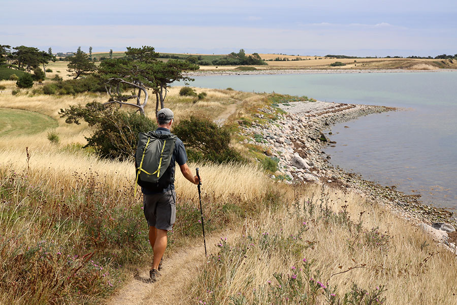 https://www.friefodspor.dk/wp-content/uploads/2022/08/Reersoe-rundt-kloeversti-sort-rute.jpg
600
900
Marie
https://www.friefodspor.dk/wp-content/uploads/2020/05/FF-logo-400-x156-_2020.png
Marie2022-08-14 09:36:302023-08-29 18:27:53VANDRERUTE Reersø rundt – jaaaa, her er smukt! (rundture fra 2,4 km til 15 km)
https://www.friefodspor.dk/wp-content/uploads/2022/08/Reersoe-rundt-kloeversti-sort-rute.jpg
600
900
Marie
https://www.friefodspor.dk/wp-content/uploads/2020/05/FF-logo-400-x156-_2020.png
Marie2022-08-14 09:36:302023-08-29 18:27:53VANDRERUTE Reersø rundt – jaaaa, her er smukt! (rundture fra 2,4 km til 15 km) https://www.friefodspor.dk/wp-content/uploads/2022/05/odsherred-blaesevejr-dragsholm-slot-vejrhoej-vingaard-kaarup-vandrerute.jpg
600
900
Marie
https://www.friefodspor.dk/wp-content/uploads/2020/05/FF-logo-400-x156-_2020.png
Marie2022-05-28 22:09:132023-08-29 18:27:58VANDRERUTE Rundtur fra Dragsholm til Vejrhøj (9,5 km rundtur)
https://www.friefodspor.dk/wp-content/uploads/2022/05/odsherred-blaesevejr-dragsholm-slot-vejrhoej-vingaard-kaarup-vandrerute.jpg
600
900
Marie
https://www.friefodspor.dk/wp-content/uploads/2020/05/FF-logo-400-x156-_2020.png
Marie2022-05-28 22:09:132023-08-29 18:27:58VANDRERUTE Rundtur fra Dragsholm til Vejrhøj (9,5 km rundtur) https://www.friefodspor.dk/wp-content/uploads/2022/05/Vejle-aadal-rundture-vandrerute-vandretur-runkebjerg-udsigter.jpg
950
1500
Marie
https://www.friefodspor.dk/wp-content/uploads/2020/05/FF-logo-400-x156-_2020.png
Marie2022-05-15 07:24:202023-08-29 18:28:00VANDRERUTE Vejle Aadal: Panoramaudsigter ved Runkebjerg (4 km rundtur)
https://www.friefodspor.dk/wp-content/uploads/2022/05/Vejle-aadal-rundture-vandrerute-vandretur-runkebjerg-udsigter.jpg
950
1500
Marie
https://www.friefodspor.dk/wp-content/uploads/2020/05/FF-logo-400-x156-_2020.png
Marie2022-05-15 07:24:202023-08-29 18:28:00VANDRERUTE Vejle Aadal: Panoramaudsigter ved Runkebjerg (4 km rundtur) https://www.friefodspor.dk/wp-content/uploads/2022/08/Haervejshytten-noerre-snede-overnatning-langs-haervejen-blokhus.jpg
602
900
Marie
https://www.friefodspor.dk/wp-content/uploads/2020/05/FF-logo-400-x156-_2020.png
Marie2022-05-05 07:51:362024-10-09 10:22:55ETAPER Overnatning indendørs på Hærvejen Hirtshals – Padborg (24 dage)
https://www.friefodspor.dk/wp-content/uploads/2022/08/Haervejshytten-noerre-snede-overnatning-langs-haervejen-blokhus.jpg
602
900
Marie
https://www.friefodspor.dk/wp-content/uploads/2020/05/FF-logo-400-x156-_2020.png
Marie2022-05-05 07:51:362024-10-09 10:22:55ETAPER Overnatning indendørs på Hærvejen Hirtshals – Padborg (24 dage)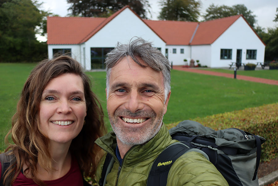 https://www.friefodspor.dk/wp-content/uploads/2022/08/thorning-haervejsherberg-overnatning-haervejen.jpg
601
900
Marie
https://www.friefodspor.dk/wp-content/uploads/2020/05/FF-logo-400-x156-_2020.png
Marie2022-05-04 16:03:032024-10-10 14:57:29ETAPER Overnatning indendørs på Hærvejen Frederikshavn – Padborg (23 dage)
https://www.friefodspor.dk/wp-content/uploads/2022/08/thorning-haervejsherberg-overnatning-haervejen.jpg
601
900
Marie
https://www.friefodspor.dk/wp-content/uploads/2020/05/FF-logo-400-x156-_2020.png
Marie2022-05-04 16:03:032024-10-10 14:57:29ETAPER Overnatning indendørs på Hærvejen Frederikshavn – Padborg (23 dage)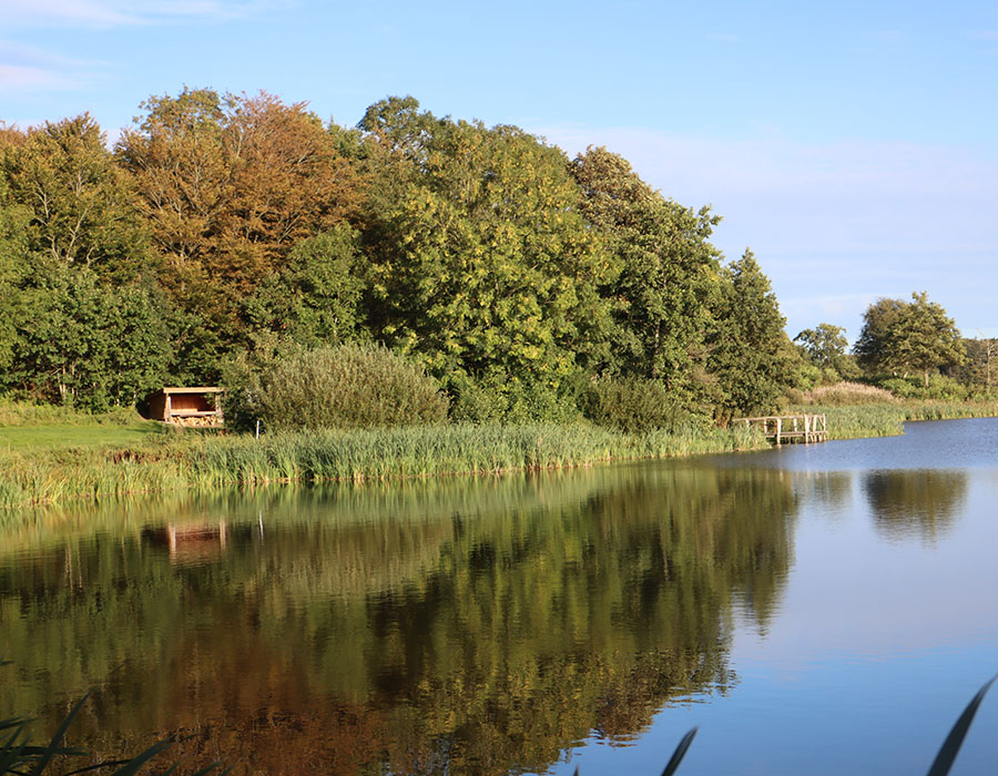 https://www.friefodspor.dk/wp-content/uploads/2022/08/klokkerholm-moellesoe-shelter-haervejen-fra-frederikshavn-shelterplads.jpg
700
900
Marie
https://www.friefodspor.dk/wp-content/uploads/2020/05/FF-logo-400-x156-_2020.png
Marie2022-05-03 20:05:152023-08-29 18:28:10ETAPER Hærvejen med telt Frederikshavn – Padborg (21 eller 20 dage)
https://www.friefodspor.dk/wp-content/uploads/2022/08/klokkerholm-moellesoe-shelter-haervejen-fra-frederikshavn-shelterplads.jpg
700
900
Marie
https://www.friefodspor.dk/wp-content/uploads/2020/05/FF-logo-400-x156-_2020.png
Marie2022-05-03 20:05:152023-08-29 18:28:10ETAPER Hærvejen med telt Frederikshavn – Padborg (21 eller 20 dage) https://www.friefodspor.dk/wp-content/uploads/2022/12/er-haervejstaeppet-i-viborg-vaerd-at-se-paa-haervejen.jpg
601
900
Marie
https://www.friefodspor.dk/wp-content/uploads/2020/05/FF-logo-400-x156-_2020.png
Marie2022-04-02 22:22:372023-08-29 18:28:12GUIDE Hærvejstæppet – en perle af en oplevelse på Hærvejen
https://www.friefodspor.dk/wp-content/uploads/2022/12/er-haervejstaeppet-i-viborg-vaerd-at-se-paa-haervejen.jpg
601
900
Marie
https://www.friefodspor.dk/wp-content/uploads/2020/05/FF-logo-400-x156-_2020.png
Marie2022-04-02 22:22:372023-08-29 18:28:12GUIDE Hærvejstæppet – en perle af en oplevelse på Hærvejen https://www.friefodspor.dk/wp-content/uploads/2022/02/kongens-borge-vandrerute-bornholm-lilleborg-bro-over-voldgraven.jpg
600
900
Marie
https://www.friefodspor.dk/wp-content/uploads/2020/05/FF-logo-400-x156-_2020.png
Marie2022-02-20 13:20:002024-11-29 11:41:56VANDRERUTE Stien til kongens borge i Almindingen (6 km rundtur)
https://www.friefodspor.dk/wp-content/uploads/2022/02/kongens-borge-vandrerute-bornholm-lilleborg-bro-over-voldgraven.jpg
600
900
Marie
https://www.friefodspor.dk/wp-content/uploads/2020/05/FF-logo-400-x156-_2020.png
Marie2022-02-20 13:20:002024-11-29 11:41:56VANDRERUTE Stien til kongens borge i Almindingen (6 km rundtur)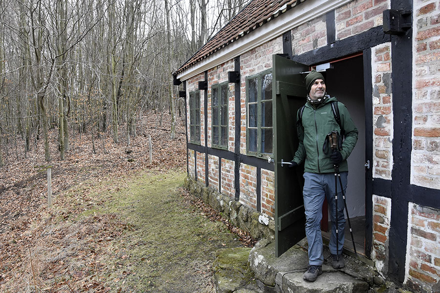 https://www.friefodspor.dk/wp-content/uploads/2022/02/Klippestien-ekkodalen-bornholm-vandrerute-jaegerhytten.jpg
600
900
Marie
https://www.friefodspor.dk/wp-content/uploads/2020/05/FF-logo-400-x156-_2020.png
Marie2022-02-20 09:00:252024-01-07 21:09:46VANDRERUTE Klippestien ved Ekkodalen (5 km rundtur)
https://www.friefodspor.dk/wp-content/uploads/2022/02/Klippestien-ekkodalen-bornholm-vandrerute-jaegerhytten.jpg
600
900
Marie
https://www.friefodspor.dk/wp-content/uploads/2020/05/FF-logo-400-x156-_2020.png
Marie2022-02-20 09:00:252024-01-07 21:09:46VANDRERUTE Klippestien ved Ekkodalen (5 km rundtur) https://www.friefodspor.dk/wp-content/uploads/2022/01/peter-bonnen-dgi-broen-ringebakkerne-broen-til-bornholm-vandreruter-vang.jpg
930
1500
Marie
https://www.friefodspor.dk/wp-content/uploads/2020/05/FF-logo-400-x156-_2020.png
Marie2022-01-19 10:34:272024-11-29 12:25:59GUIDE Vintervandreferie på Bornholm – her er faktisk åbent!
https://www.friefodspor.dk/wp-content/uploads/2022/01/peter-bonnen-dgi-broen-ringebakkerne-broen-til-bornholm-vandreruter-vang.jpg
930
1500
Marie
https://www.friefodspor.dk/wp-content/uploads/2020/05/FF-logo-400-x156-_2020.png
Marie2022-01-19 10:34:272024-11-29 12:25:59GUIDE Vintervandreferie på Bornholm – her er faktisk åbent! https://www.friefodspor.dk/wp-content/uploads/2022/01/shelter-vang-granitbrud-vandrerute-bornholm-vang.jpg
600
900
Marie
https://www.friefodspor.dk/wp-content/uploads/2020/05/FF-logo-400-x156-_2020.png
Marie2022-01-18 12:23:042024-11-29 12:26:37VANDRERUTE Ringebakkerne på Bornholm (rundture på 2½, 4 og 5 km)
https://www.friefodspor.dk/wp-content/uploads/2022/01/shelter-vang-granitbrud-vandrerute-bornholm-vang.jpg
600
900
Marie
https://www.friefodspor.dk/wp-content/uploads/2020/05/FF-logo-400-x156-_2020.png
Marie2022-01-18 12:23:042024-11-29 12:26:37VANDRERUTE Ringebakkerne på Bornholm (rundture på 2½, 4 og 5 km) https://www.friefodspor.dk/wp-content/uploads/2022/01/solnedgang-over-hammershus-vinterferie-paa-bornholm.jpg
601
900
Marie
https://www.friefodspor.dk/wp-content/uploads/2020/05/FF-logo-400-x156-_2020.png
Marie2022-01-18 11:54:482024-11-29 12:27:31VANDRERUTE Finnens fodspor på Bornholm (6 km rundtur)
https://www.friefodspor.dk/wp-content/uploads/2022/01/solnedgang-over-hammershus-vinterferie-paa-bornholm.jpg
601
900
Marie
https://www.friefodspor.dk/wp-content/uploads/2020/05/FF-logo-400-x156-_2020.png
Marie2022-01-18 11:54:482024-11-29 12:27:31VANDRERUTE Finnens fodspor på Bornholm (6 km rundtur)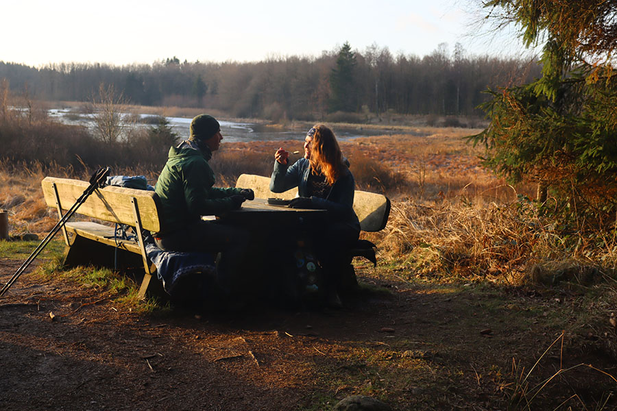 https://www.friefodspor.dk/wp-content/uploads/2022/01/Bisonstien-bornholm-vandrerute-svinemosen-prinsgemalens-baenk.jpg
600
900
Marie
https://www.friefodspor.dk/wp-content/uploads/2020/05/FF-logo-400-x156-_2020.png
Marie2022-01-18 10:19:292024-11-29 12:28:14VANDRERUTE Bisonstien på Bornholm (12 km rundtur)
https://www.friefodspor.dk/wp-content/uploads/2022/01/Bisonstien-bornholm-vandrerute-svinemosen-prinsgemalens-baenk.jpg
600
900
Marie
https://www.friefodspor.dk/wp-content/uploads/2020/05/FF-logo-400-x156-_2020.png
Marie2022-01-18 10:19:292024-11-29 12:28:14VANDRERUTE Bisonstien på Bornholm (12 km rundtur)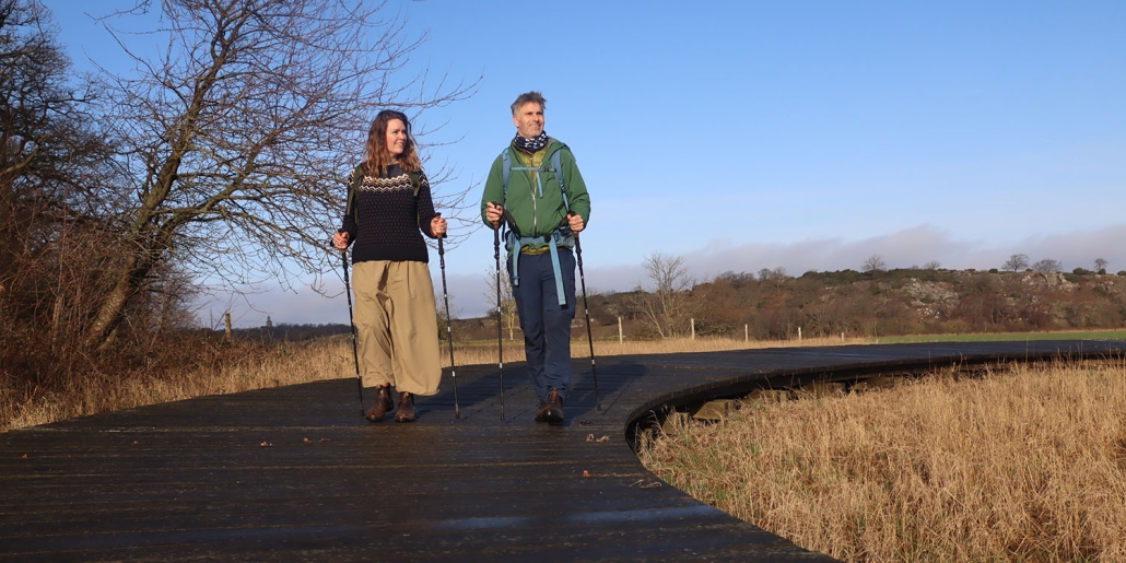 https://www.friefodspor.dk/wp-content/uploads/2022/01/cirkelstien-bornholm-allinge-hammershus-boardwalks.jpg
750
1500
Marie
https://www.friefodspor.dk/wp-content/uploads/2020/05/FF-logo-400-x156-_2020.png
Marie2022-01-18 09:17:482023-08-29 18:28:21VANDRERUTE Cirkelstien på Bornholm (2,7 km A til B)
https://www.friefodspor.dk/wp-content/uploads/2022/01/cirkelstien-bornholm-allinge-hammershus-boardwalks.jpg
750
1500
Marie
https://www.friefodspor.dk/wp-content/uploads/2020/05/FF-logo-400-x156-_2020.png
Marie2022-01-18 09:17:482023-08-29 18:28:21VANDRERUTE Cirkelstien på Bornholm (2,7 km A til B)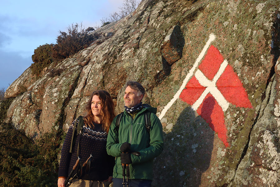 https://www.friefodspor.dk/wp-content/uploads/2022/01/flaget-sandvig-stenhuggerstien-vandreferie-paa-bornholm.jpg
601
900
Marie
https://www.friefodspor.dk/wp-content/uploads/2020/05/FF-logo-400-x156-_2020.png
Marie2022-01-18 07:09:332024-11-29 12:30:14VANDRERUTE Stenhuggerstien på Bornholm (5,5 km rundtur)
https://www.friefodspor.dk/wp-content/uploads/2022/01/flaget-sandvig-stenhuggerstien-vandreferie-paa-bornholm.jpg
601
900
Marie
https://www.friefodspor.dk/wp-content/uploads/2020/05/FF-logo-400-x156-_2020.png
Marie2022-01-18 07:09:332024-11-29 12:30:14VANDRERUTE Stenhuggerstien på Bornholm (5,5 km rundtur)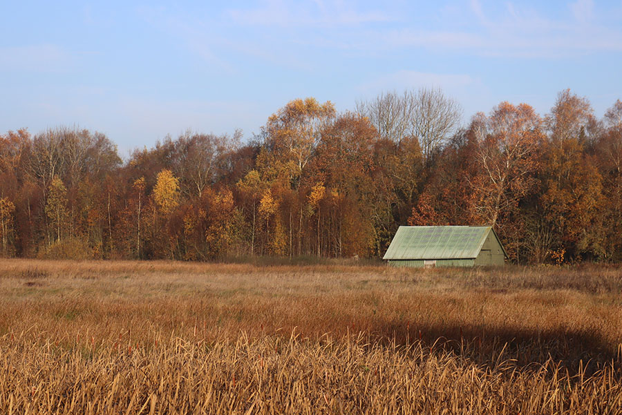 https://www.friefodspor.dk/wp-content/uploads/2021/12/kloeverstier-engesvang-vandrerute-rundtur-efteraarsfarver-lade.jpg
601
900
Marie
https://www.friefodspor.dk/wp-content/uploads/2020/05/FF-logo-400-x156-_2020.png
Marie2021-12-02 10:40:082023-09-18 21:28:43VANDRERUTE Kløverstierne i Engesvang og Bølling Sø rundt (rundture på 2,5 til 12,7 km)
https://www.friefodspor.dk/wp-content/uploads/2021/12/kloeverstier-engesvang-vandrerute-rundtur-efteraarsfarver-lade.jpg
601
900
Marie
https://www.friefodspor.dk/wp-content/uploads/2020/05/FF-logo-400-x156-_2020.png
Marie2021-12-02 10:40:082023-09-18 21:28:43VANDRERUTE Kløverstierne i Engesvang og Bølling Sø rundt (rundture på 2,5 til 12,7 km)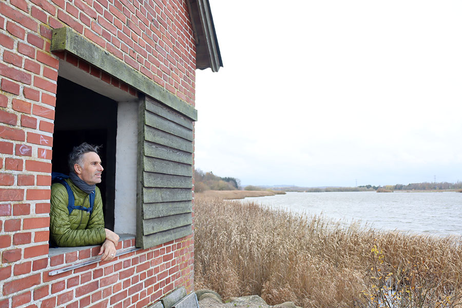 https://www.friefodspor.dk/wp-content/uploads/2021/11/aarslev-engsoe-rundt-vandrerute-fugletaarn-candre-udsigt-fugletur.jpg
601
900
Marie
https://www.friefodspor.dk/wp-content/uploads/2020/05/FF-logo-400-x156-_2020.png
Marie2021-11-21 16:09:132023-08-29 18:28:42VANDRERUTE Aarslev Engsø rundt (9,5 km)
https://www.friefodspor.dk/wp-content/uploads/2021/11/aarslev-engsoe-rundt-vandrerute-fugletaarn-candre-udsigt-fugletur.jpg
601
900
Marie
https://www.friefodspor.dk/wp-content/uploads/2020/05/FF-logo-400-x156-_2020.png
Marie2021-11-21 16:09:132023-08-29 18:28:42VANDRERUTE Aarslev Engsø rundt (9,5 km) https://www.friefodspor.dk/wp-content/uploads/2021/09/vandreblogger-marie-lau-florin-hoesterkoeb-vandrerute-ravnsnaes-skolesti.jpg
600
900
Marie
https://www.friefodspor.dk/wp-content/uploads/2020/05/FF-logo-400-x156-_2020.png
Marie2021-09-25 19:51:552024-03-03 12:41:07VANDRERUTE Høsterkøb rundt 12 km
https://www.friefodspor.dk/wp-content/uploads/2021/09/vandreblogger-marie-lau-florin-hoesterkoeb-vandrerute-ravnsnaes-skolesti.jpg
600
900
Marie
https://www.friefodspor.dk/wp-content/uploads/2020/05/FF-logo-400-x156-_2020.png
Marie2021-09-25 19:51:552024-03-03 12:41:07VANDRERUTE Høsterkøb rundt 12 km https://www.friefodspor.dk/wp-content/uploads/2021/08/store-dyrehave-sorte-mose-raagaardshus.jpg
830
1500
Marie
https://www.friefodspor.dk/wp-content/uploads/2020/05/FF-logo-400-x156-_2020.png
Marie2021-08-29 16:13:302023-08-29 18:28:53VANDRERUTE Store Dyrehaves parforcejagtstier (13 km rundtur)
https://www.friefodspor.dk/wp-content/uploads/2021/08/store-dyrehave-sorte-mose-raagaardshus.jpg
830
1500
Marie
https://www.friefodspor.dk/wp-content/uploads/2020/05/FF-logo-400-x156-_2020.png
Marie2021-08-29 16:13:302023-08-29 18:28:53VANDRERUTE Store Dyrehaves parforcejagtstier (13 km rundtur) https://www.friefodspor.dk/wp-content/uploads/2021/07/lillebaeltstien-vandrerute-paa-fyn-middelfart-pausested.jpg
604
900
Marie
https://www.friefodspor.dk/wp-content/uploads/2020/05/FF-logo-400-x156-_2020.png
Marie2021-07-31 17:26:012025-01-02 17:03:48VANDRERUTE Lillebæltsstien (27 km A til B eller 12 km rundtur)
https://www.friefodspor.dk/wp-content/uploads/2021/07/lillebaeltstien-vandrerute-paa-fyn-middelfart-pausested.jpg
604
900
Marie
https://www.friefodspor.dk/wp-content/uploads/2020/05/FF-logo-400-x156-_2020.png
Marie2021-07-31 17:26:012025-01-02 17:03:48VANDRERUTE Lillebæltsstien (27 km A til B eller 12 km rundtur) https://www.friefodspor.dk/wp-content/uploads/2021/01/himmelbjergruten-vandring-vandrerute-silkeborg-stier-silkeborgsoerne-kys-par.jpg
600
900
Marie
https://www.friefodspor.dk/wp-content/uploads/2020/05/FF-logo-400-x156-_2020.png
Marie2021-07-29 20:51:442024-06-19 21:06:48Himmelbjergruten (54 km rundtur)
https://www.friefodspor.dk/wp-content/uploads/2021/01/himmelbjergruten-vandring-vandrerute-silkeborg-stier-silkeborgsoerne-kys-par.jpg
600
900
Marie
https://www.friefodspor.dk/wp-content/uploads/2020/05/FF-logo-400-x156-_2020.png
Marie2021-07-29 20:51:442024-06-19 21:06:48Himmelbjergruten (54 km rundtur) https://www.friefodspor.dk/wp-content/uploads/2023/07/vandrerute-maribo-naturpark-maribosoeerne-rundt-rundtur-lolland-gaatur-soe-badebro.jpg
900
1500
Marie
https://www.friefodspor.dk/wp-content/uploads/2020/05/FF-logo-400-x156-_2020.png
Marie2021-07-23 22:36:272023-08-29 18:28:58VANDRERUTE Søndersø rundt i Maribo (24 km)
https://www.friefodspor.dk/wp-content/uploads/2023/07/vandrerute-maribo-naturpark-maribosoeerne-rundt-rundtur-lolland-gaatur-soe-badebro.jpg
900
1500
Marie
https://www.friefodspor.dk/wp-content/uploads/2020/05/FF-logo-400-x156-_2020.png
Marie2021-07-23 22:36:272023-08-29 18:28:58VANDRERUTE Søndersø rundt i Maribo (24 km)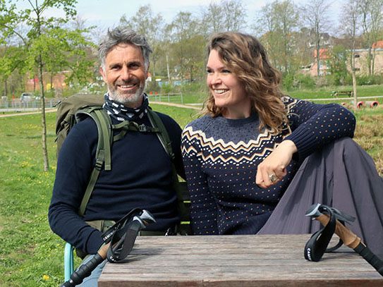 https://www.friefodspor.dk/wp-content/uploads/2021/07/vandrerute-viborg-viborgsoerne-rundt-pausested-vandring-lille.jpg
407
543
Marie
https://www.friefodspor.dk/wp-content/uploads/2020/05/FF-logo-400-x156-_2020.png
Marie2021-07-23 18:56:222023-08-29 18:29:00VANDRERUTE Viborgsøerne rundt (11 km)
https://www.friefodspor.dk/wp-content/uploads/2021/07/vandrerute-viborg-viborgsoerne-rundt-pausested-vandring-lille.jpg
407
543
Marie
https://www.friefodspor.dk/wp-content/uploads/2020/05/FF-logo-400-x156-_2020.png
Marie2021-07-23 18:56:222023-08-29 18:29:00VANDRERUTE Viborgsøerne rundt (11 km) https://www.friefodspor.dk/wp-content/uploads/2021/06/vandrerute-roskilde-skjoldungestien-tunnel-alle-900.jpg
600
900
Marie
https://www.friefodspor.dk/wp-content/uploads/2020/05/FF-logo-400-x156-_2020.png
Marie2021-06-25 16:27:122024-01-29 10:25:30GUIDE Skjoldungestien (31+10 km A til B)
https://www.friefodspor.dk/wp-content/uploads/2021/06/vandrerute-roskilde-skjoldungestien-tunnel-alle-900.jpg
600
900
Marie
https://www.friefodspor.dk/wp-content/uploads/2020/05/FF-logo-400-x156-_2020.png
Marie2021-06-25 16:27:122024-01-29 10:25:30GUIDE Skjoldungestien (31+10 km A til B) https://www.friefodspor.dk/wp-content/uploads/2021/06/Helvede-i-nord-vandrerute-tisvilde-hegn-gaa-i-sand-trekkingsandaler.jpg
600
900
Marie
https://www.friefodspor.dk/wp-content/uploads/2020/05/FF-logo-400-x156-_2020.png
Marie2021-06-06 20:05:312023-08-29 18:29:06VANDRERUTE Helvede i Nord i Tisvilde Hegn (21,2 eller 12 km rundtur)
https://www.friefodspor.dk/wp-content/uploads/2021/06/Helvede-i-nord-vandrerute-tisvilde-hegn-gaa-i-sand-trekkingsandaler.jpg
600
900
Marie
https://www.friefodspor.dk/wp-content/uploads/2020/05/FF-logo-400-x156-_2020.png
Marie2021-06-06 20:05:312023-08-29 18:29:06VANDRERUTE Helvede i Nord i Tisvilde Hegn (21,2 eller 12 km rundtur)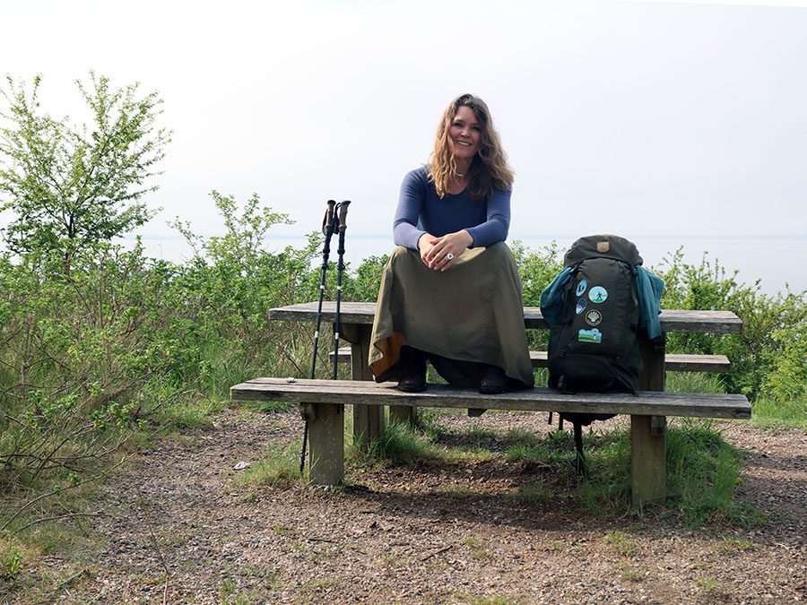 https://www.friefodspor.dk/wp-content/uploads/2021/05/esrum-tisvildevejen-vandrerute-vandreblogger-nordsjaelland-900.jpg
675
900
Marie
https://www.friefodspor.dk/wp-content/uploads/2020/05/FF-logo-400-x156-_2020.png
Marie2021-05-11 11:34:502023-08-29 18:29:45GUIDE Esrum-Tisvildevejen 77 km stille, bakkede Nordsjælland (A til B eller rundture)
https://www.friefodspor.dk/wp-content/uploads/2021/05/esrum-tisvildevejen-vandrerute-vandreblogger-nordsjaelland-900.jpg
675
900
Marie
https://www.friefodspor.dk/wp-content/uploads/2020/05/FF-logo-400-x156-_2020.png
Marie2021-05-11 11:34:502023-08-29 18:29:45GUIDE Esrum-Tisvildevejen 77 km stille, bakkede Nordsjælland (A til B eller rundture) https://www.friefodspor.dk/wp-content/uploads/2021/05/marskstien-vandrerute-soenderjylland-laegan-pumpestation-udstilling-vandrepakke.jpg
675
900
Marie
https://www.friefodspor.dk/wp-content/uploads/2020/05/FF-logo-400-x156-_2020.png
Marie2021-05-03 11:00:222024-06-03 12:19:29GUIDE Marskstien – 54 km åben himmel
https://www.friefodspor.dk/wp-content/uploads/2021/05/marskstien-vandrerute-soenderjylland-laegan-pumpestation-udstilling-vandrepakke.jpg
675
900
Marie
https://www.friefodspor.dk/wp-content/uploads/2020/05/FF-logo-400-x156-_2020.png
Marie2021-05-03 11:00:222024-06-03 12:19:29GUIDE Marskstien – 54 km åben himmel https://www.friefodspor.dk/wp-content/uploads/2021/05/vandring-vadehavet-vandrerute-romo-romostierne-skiltet-rute-sti-gaatur-vandreblog-vandreblogger-vandreferie-i-danmark.jpg
678
900
Marie
https://www.friefodspor.dk/wp-content/uploads/2020/05/FF-logo-400-x156-_2020.png
Marie2021-05-02 21:49:182024-07-23 12:17:19VANDRERUTE Rømø – en perle af en vandrerute ved Vadehavet (17 km rundtur)
https://www.friefodspor.dk/wp-content/uploads/2021/05/vandring-vadehavet-vandrerute-romo-romostierne-skiltet-rute-sti-gaatur-vandreblog-vandreblogger-vandreferie-i-danmark.jpg
678
900
Marie
https://www.friefodspor.dk/wp-content/uploads/2020/05/FF-logo-400-x156-_2020.png
Marie2021-05-02 21:49:182024-07-23 12:17:19VANDRERUTE Rømø – en perle af en vandrerute ved Vadehavet (17 km rundtur) https://www.friefodspor.dk/wp-content/uploads/2021/04/Fanefjord-skov-vandrerute.moen-vestmoen.jpg
675
900
Marie
https://www.friefodspor.dk/wp-content/uploads/2020/05/FF-logo-400-x156-_2020.png
Marie2021-04-22 10:02:392023-08-29 18:29:54VANDRERUTE Vestmøn rundt i hippiernes fodspor (19 km)
https://www.friefodspor.dk/wp-content/uploads/2021/04/Fanefjord-skov-vandrerute.moen-vestmoen.jpg
675
900
Marie
https://www.friefodspor.dk/wp-content/uploads/2020/05/FF-logo-400-x156-_2020.png
Marie2021-04-22 10:02:392023-08-29 18:29:54VANDRERUTE Vestmøn rundt i hippiernes fodspor (19 km) https://www.friefodspor.dk/wp-content/uploads/2021/03/Moens-klint-camoenoen-vandrerute.jpg
675
900
Marie
https://www.friefodspor.dk/wp-content/uploads/2020/05/FF-logo-400-x156-_2020.png
Marie2021-04-06 11:47:252023-08-29 18:29:56INDBLIK Vandreferie på Camønoen – i medgang og modgang
https://www.friefodspor.dk/wp-content/uploads/2021/03/Moens-klint-camoenoen-vandrerute.jpg
675
900
Marie
https://www.friefodspor.dk/wp-content/uploads/2020/05/FF-logo-400-x156-_2020.png
Marie2021-04-06 11:47:252023-08-29 18:29:56INDBLIK Vandreferie på Camønoen – i medgang og modgang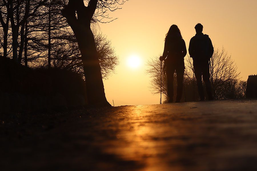 https://www.friefodspor.dk/wp-content/uploads/2021/01/solopgang-paa-camoenoen-busene-vandring-asfalt-rygsaek.jpg
600
900
Marie
https://www.friefodspor.dk/wp-content/uploads/2020/05/FF-logo-400-x156-_2020.png
Marie2021-03-28 20:54:122023-08-29 18:29:59GUIDE Camønoen
https://www.friefodspor.dk/wp-content/uploads/2021/01/solopgang-paa-camoenoen-busene-vandring-asfalt-rygsaek.jpg
600
900
Marie
https://www.friefodspor.dk/wp-content/uploads/2020/05/FF-logo-400-x156-_2020.png
Marie2021-03-28 20:54:122023-08-29 18:29:59GUIDE Camønoen https://www.friefodspor.dk/wp-content/uploads/2021/03/de-gule-prikker-rude-skov-skiltet-gaatur.jpg
600
900
Marie
https://www.friefodspor.dk/wp-content/uploads/2020/05/FF-logo-400-x156-_2020.png
Marie2021-03-13 08:46:402023-08-29 18:30:03VANDRERUTE De gule prikker i Rude Skov (7+5 km rundtur)
https://www.friefodspor.dk/wp-content/uploads/2021/03/de-gule-prikker-rude-skov-skiltet-gaatur.jpg
600
900
Marie
https://www.friefodspor.dk/wp-content/uploads/2020/05/FF-logo-400-x156-_2020.png
Marie2021-03-13 08:46:402023-08-29 18:30:03VANDRERUTE De gule prikker i Rude Skov (7+5 km rundtur) https://www.friefodspor.dk/wp-content/uploads/2021/02/Kloeverstierne-i-hoersholm-vandrerute-vandretur-i-usseroed-sne-vintervandring-is.jpg
750
1500
Marie
https://www.friefodspor.dk/wp-content/uploads/2020/05/FF-logo-400-x156-_2020.png
Marie2021-02-24 14:14:112023-08-29 18:30:08VANDRERUTE Kløverstierne i Hørsholm (rundture på 2,6 til 21 km)
https://www.friefodspor.dk/wp-content/uploads/2021/02/Kloeverstierne-i-hoersholm-vandrerute-vandretur-i-usseroed-sne-vintervandring-is.jpg
750
1500
Marie
https://www.friefodspor.dk/wp-content/uploads/2020/05/FF-logo-400-x156-_2020.png
Marie2021-02-24 14:14:112023-08-29 18:30:08VANDRERUTE Kløverstierne i Hørsholm (rundture på 2,6 til 21 km) https://www.friefodspor.dk/wp-content/uploads/2022/05/Vandrerute-roervig-korshage-hoejsandet-pause-termokande.jpg
601
900
Marie
https://www.friefodspor.dk/wp-content/uploads/2020/05/FF-logo-400-x156-_2020.png
Marie2021-02-23 16:49:392023-08-29 18:30:10VANDRERUTE Rundt om Rørvig fra Højsandet til Korshage (11 km)
https://www.friefodspor.dk/wp-content/uploads/2022/05/Vandrerute-roervig-korshage-hoejsandet-pause-termokande.jpg
601
900
Marie
https://www.friefodspor.dk/wp-content/uploads/2020/05/FF-logo-400-x156-_2020.png
Marie2021-02-23 16:49:392023-08-29 18:30:10VANDRERUTE Rundt om Rørvig fra Højsandet til Korshage (11 km)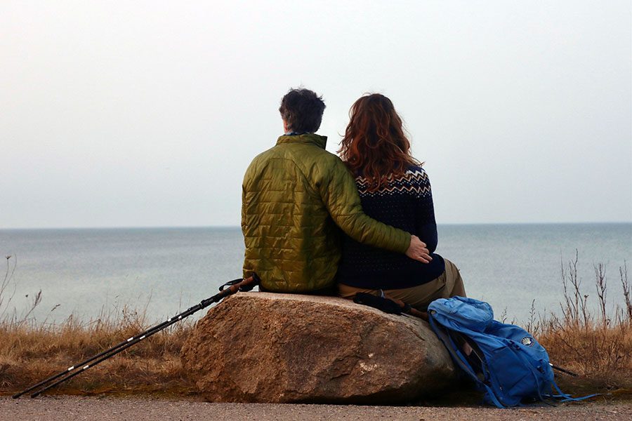 https://www.friefodspor.dk/wp-content/uploads/2021/02/vandrerute-103-sjaellands-odde-kyst-til-kyst-aftenlys-romantik-odsherred.jpg
600
900
Marie
https://www.friefodspor.dk/wp-content/uploads/2020/05/FF-logo-400-x156-_2020.png
Marie2021-02-23 16:45:532023-08-29 18:30:12VANDRERUTE Fra kyst til kyst på Sjællands Odde (12,5 km rundtur)
https://www.friefodspor.dk/wp-content/uploads/2021/02/vandrerute-103-sjaellands-odde-kyst-til-kyst-aftenlys-romantik-odsherred.jpg
600
900
Marie
https://www.friefodspor.dk/wp-content/uploads/2020/05/FF-logo-400-x156-_2020.png
Marie2021-02-23 16:45:532023-08-29 18:30:12VANDRERUTE Fra kyst til kyst på Sjællands Odde (12,5 km rundtur) https://www.friefodspor.dk/wp-content/uploads/2021/02/vandretur-sti-annebjerg-anneberg-ulkerup-skov-sjaelene-kunstvaerk-skiltet-vandrerute-122.jpg
600
900
Marie
https://www.friefodspor.dk/wp-content/uploads/2020/05/FF-logo-400-x156-_2020.png
Marie2021-02-20 18:01:242023-08-29 18:30:13VANDRERUTE Annebjerg og Ulkerup skov (11,3 km rundtur)
https://www.friefodspor.dk/wp-content/uploads/2021/02/vandretur-sti-annebjerg-anneberg-ulkerup-skov-sjaelene-kunstvaerk-skiltet-vandrerute-122.jpg
600
900
Marie
https://www.friefodspor.dk/wp-content/uploads/2020/05/FF-logo-400-x156-_2020.png
Marie2021-02-20 18:01:242023-08-29 18:30:13VANDRERUTE Annebjerg og Ulkerup skov (11,3 km rundtur) https://www.friefodspor.dk/wp-content/uploads/2021/01/vandretur-ordrup-naes-odsherred-kaarup-skov-bakker-madpakke-baad.jpg
550
900
Marie
https://www.friefodspor.dk/wp-content/uploads/2020/05/FF-logo-400-x156-_2020.png
Marie2021-01-20 20:15:202023-08-29 18:30:15VANDRERUTE Overfed rute: Ordrup Næs og Kårup Skov (13,6 km rundtur)
https://www.friefodspor.dk/wp-content/uploads/2021/01/vandretur-ordrup-naes-odsherred-kaarup-skov-bakker-madpakke-baad.jpg
550
900
Marie
https://www.friefodspor.dk/wp-content/uploads/2020/05/FF-logo-400-x156-_2020.png
Marie2021-01-20 20:15:202023-08-29 18:30:15VANDRERUTE Overfed rute: Ordrup Næs og Kårup Skov (13,6 km rundtur) https://www.friefodspor.dk/wp-content/uploads/2021/01/vintervandring-hellebaekl-kohave-hammermoellen-vandrerute.jpg
600
900
Marie
https://www.friefodspor.dk/wp-content/uploads/2020/05/FF-logo-400-x156-_2020.png
Marie2021-01-14 09:54:232023-08-29 18:30:18VANDRERUTE Rundture ved Hammermøllen i Hellebæk (5 og 5,5 km)
https://www.friefodspor.dk/wp-content/uploads/2021/01/vintervandring-hellebaekl-kohave-hammermoellen-vandrerute.jpg
600
900
Marie
https://www.friefodspor.dk/wp-content/uploads/2020/05/FF-logo-400-x156-_2020.png
Marie2021-01-14 09:54:232023-08-29 18:30:18VANDRERUTE Rundture ved Hammermøllen i Hellebæk (5 og 5,5 km)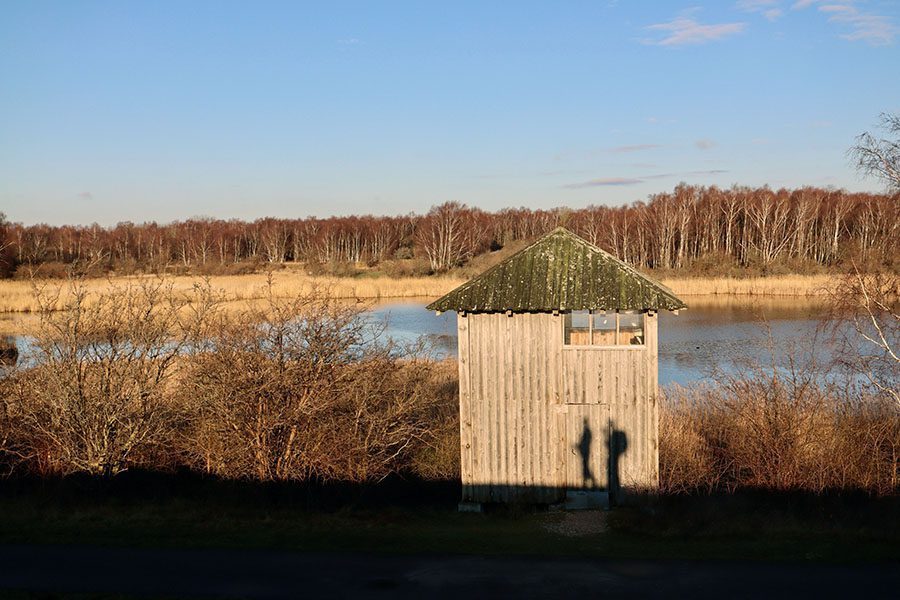 https://www.friefodspor.dk/wp-content/uploads/2021/01/kongelunden-vandring-amaminoen-amagerminoen-cyklister.jpg
600
900
Marie
https://www.friefodspor.dk/wp-content/uploads/2020/05/FF-logo-400-x156-_2020.png
Marie2021-01-09 19:32:082023-08-29 18:30:20VANDRERUTE Amarminoen: By vs. natur (27 km A til B)
https://www.friefodspor.dk/wp-content/uploads/2021/01/kongelunden-vandring-amaminoen-amagerminoen-cyklister.jpg
600
900
Marie
https://www.friefodspor.dk/wp-content/uploads/2020/05/FF-logo-400-x156-_2020.png
Marie2021-01-09 19:32:082023-08-29 18:30:20VANDRERUTE Amarminoen: By vs. natur (27 km A til B) https://www.friefodspor.dk/wp-content/uploads/2021/01/vandrerute-vandretur-soroe-soe-pedersborg-soe-tuelsoe-taage-lystfisker.jpg
600
900
Marie
https://www.friefodspor.dk/wp-content/uploads/2020/05/FF-logo-400-x156-_2020.png
Marie2021-01-03 20:29:512023-08-29 18:30:22VANDRERUTE Sorøsøerne rundt (22 km)
https://www.friefodspor.dk/wp-content/uploads/2021/01/vandrerute-vandretur-soroe-soe-pedersborg-soe-tuelsoe-taage-lystfisker.jpg
600
900
Marie
https://www.friefodspor.dk/wp-content/uploads/2020/05/FF-logo-400-x156-_2020.png
Marie2021-01-03 20:29:512023-08-29 18:30:22VANDRERUTE Sorøsøerne rundt (22 km)  https://www.friefodspor.dk/wp-content/uploads/2021/01/raadvad-vandretur-vandrerute-vandre-moelleaastien-moelleaadalen.jpg
500
900
Marie
https://www.friefodspor.dk/wp-content/uploads/2020/05/FF-logo-400-x156-_2020.png
Marie2021-01-03 17:51:462023-08-29 18:30:23VANDRERUTE: Mølleåstien fra Buresø til Øresund 37 km A til B (eller 14 + 12 + 11 km)
https://www.friefodspor.dk/wp-content/uploads/2021/01/raadvad-vandretur-vandrerute-vandre-moelleaastien-moelleaadalen.jpg
500
900
Marie
https://www.friefodspor.dk/wp-content/uploads/2020/05/FF-logo-400-x156-_2020.png
Marie2021-01-03 17:51:462023-08-29 18:30:23VANDRERUTE: Mølleåstien fra Buresø til Øresund 37 km A til B (eller 14 + 12 + 11 km) https://www.friefodspor.dk/wp-content/uploads/2020/12/vandrerute-mellem-kaemperne-paa-vestegnen-lille-tilde-vandrerute.jpg
600
900
Marie
https://www.friefodspor.dk/wp-content/uploads/2020/05/FF-logo-400-x156-_2020.png
Marie2020-12-07 08:22:422023-08-29 18:30:26VANDRERUTE På skattejagt efter Kæmperne på Vestegnen (19+16 km A til B)
https://www.friefodspor.dk/wp-content/uploads/2020/12/vandrerute-mellem-kaemperne-paa-vestegnen-lille-tilde-vandrerute.jpg
600
900
Marie
https://www.friefodspor.dk/wp-content/uploads/2020/05/FF-logo-400-x156-_2020.png
Marie2020-12-07 08:22:422023-08-29 18:30:26VANDRERUTE På skattejagt efter Kæmperne på Vestegnen (19+16 km A til B)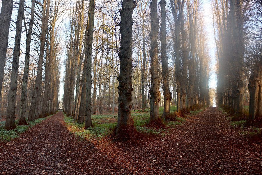 https://www.friefodspor.dk/wp-content/uploads/2020/11/vandrerute-jaegerspris-slot-slotshave-alle.jpg
600
900
Marie
https://www.friefodspor.dk/wp-content/uploads/2020/05/FF-logo-400-x156-_2020.png
Marie2020-11-26 15:37:342023-08-29 18:30:28VANDRERUTE Rundtur ved Jægerspris Slot (8,5 km)
https://www.friefodspor.dk/wp-content/uploads/2020/11/vandrerute-jaegerspris-slot-slotshave-alle.jpg
600
900
Marie
https://www.friefodspor.dk/wp-content/uploads/2020/05/FF-logo-400-x156-_2020.png
Marie2020-11-26 15:37:342023-08-29 18:30:28VANDRERUTE Rundtur ved Jægerspris Slot (8,5 km)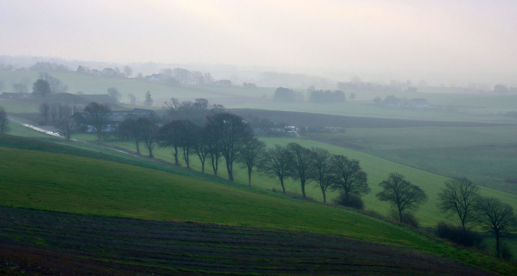 https://www.friefodspor.dk/wp-content/uploads/2020/11/hoejderygstien-odsherred-vandrerute-gaatur-skiltet-rute.jpg
800
1500
Marie
https://www.friefodspor.dk/wp-content/uploads/2020/05/FF-logo-400-x156-_2020.png
Marie2020-11-26 11:11:292023-08-29 18:30:30VANDRERUTE Højderygstien: 7 km gennem Odsherreds istidslandskaber (A til B)
https://www.friefodspor.dk/wp-content/uploads/2020/11/hoejderygstien-odsherred-vandrerute-gaatur-skiltet-rute.jpg
800
1500
Marie
https://www.friefodspor.dk/wp-content/uploads/2020/05/FF-logo-400-x156-_2020.png
Marie2020-11-26 11:11:292023-08-29 18:30:30VANDRERUTE Højderygstien: 7 km gennem Odsherreds istidslandskaber (A til B) https://www.friefodspor.dk/wp-content/uploads/2020/11/roesnaes-rundt-vandrerute-guide.jpg
750
1500
Marie
https://www.friefodspor.dk/wp-content/uploads/2020/05/FF-logo-400-x156-_2020.png
Marie2020-11-24 20:01:302024-05-27 18:31:16VANDRERUTE Røsnæs rundt (25 km eller 14,5 km)
https://www.friefodspor.dk/wp-content/uploads/2020/11/roesnaes-rundt-vandrerute-guide.jpg
750
1500
Marie
https://www.friefodspor.dk/wp-content/uploads/2020/05/FF-logo-400-x156-_2020.png
Marie2020-11-24 20:01:302024-05-27 18:31:16VANDRERUTE Røsnæs rundt (25 km eller 14,5 km)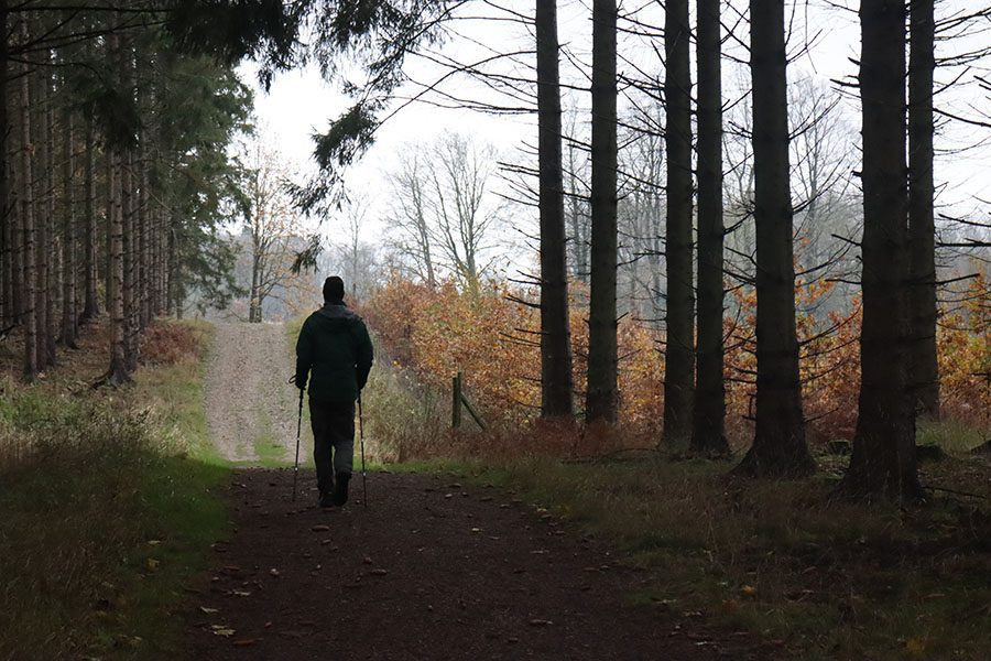 https://www.friefodspor.dk/wp-content/uploads/2020/11/skarresoe-rundt-jyderup-odsherred-vandreture-vandrerute-skiltet-skov-lodsejer-1.jpg
600
900
Marie
https://www.friefodspor.dk/wp-content/uploads/2020/05/FF-logo-400-x156-_2020.png
Marie2020-11-21 18:42:182023-08-29 18:30:34VANDRERUTE Skønne Skarresø rundt (11 km)
https://www.friefodspor.dk/wp-content/uploads/2020/11/skarresoe-rundt-jyderup-odsherred-vandreture-vandrerute-skiltet-skov-lodsejer-1.jpg
600
900
Marie
https://www.friefodspor.dk/wp-content/uploads/2020/05/FF-logo-400-x156-_2020.png
Marie2020-11-21 18:42:182023-08-29 18:30:34VANDRERUTE Skønne Skarresø rundt (11 km)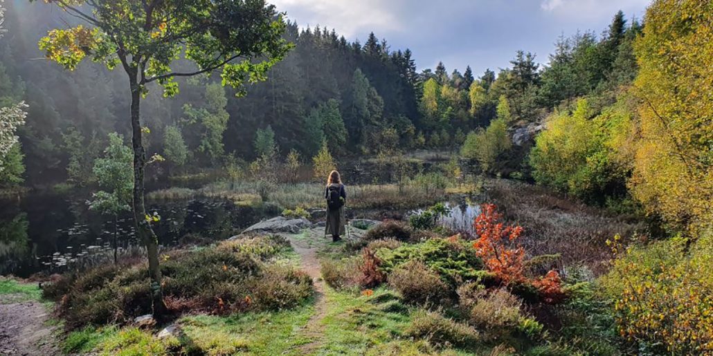 https://www.friefodspor.dk/wp-content/uploads/2020/10/vandring-paa-hoejlyngsstien-paa-bornholm-efteraar.jpg
750
1500
Marie
https://www.friefodspor.dk/wp-content/uploads/2020/05/FF-logo-400-x156-_2020.png
Marie2020-10-17 09:12:082024-01-15 13:22:47INDBLIK Min indre Ronja Røverdatter: Højlyngsstien på Bornholm
https://www.friefodspor.dk/wp-content/uploads/2020/10/vandring-paa-hoejlyngsstien-paa-bornholm-efteraar.jpg
750
1500
Marie
https://www.friefodspor.dk/wp-content/uploads/2020/05/FF-logo-400-x156-_2020.png
Marie2020-10-17 09:12:082024-01-15 13:22:47INDBLIK Min indre Ronja Røverdatter: Højlyngsstien på Bornholm https://www.friefodspor.dk/wp-content/uploads/2020/09/havneringen-vandrerute-konstraster-urban-oerstedvaerket-vandrere.jpg
600
900
Marie
https://www.friefodspor.dk/wp-content/uploads/2020/05/FF-logo-400-x156-_2020.png
Marie2020-09-08 10:46:072023-08-29 18:30:48VANDRERUTE Havneringen – blæst tilbage af København (14 km rundtur)
https://www.friefodspor.dk/wp-content/uploads/2020/09/havneringen-vandrerute-konstraster-urban-oerstedvaerket-vandrere.jpg
600
900
Marie
https://www.friefodspor.dk/wp-content/uploads/2020/05/FF-logo-400-x156-_2020.png
Marie2020-09-08 10:46:072023-08-29 18:30:48VANDRERUTE Havneringen – blæst tilbage af København (14 km rundtur) https://www.friefodspor.dk/wp-content/uploads/2020/08/vandrerute-marienborg-moelleaaen-bagsvaerd-soe-lyngby-soe-rundt.jpg
600
900
Marie
https://www.friefodspor.dk/wp-content/uploads/2020/05/FF-logo-400-x156-_2020.png
Marie2020-08-22 14:27:242023-08-30 22:02:13VANDRERUTE Rundt om Lyngby og Bagsværd Sø (13 km eller 6 + 7 km)
https://www.friefodspor.dk/wp-content/uploads/2020/08/vandrerute-marienborg-moelleaaen-bagsvaerd-soe-lyngby-soe-rundt.jpg
600
900
Marie
https://www.friefodspor.dk/wp-content/uploads/2020/05/FF-logo-400-x156-_2020.png
Marie2020-08-22 14:27:242023-08-30 22:02:13VANDRERUTE Rundt om Lyngby og Bagsværd Sø (13 km eller 6 + 7 km) https://www.friefodspor.dk/wp-content/uploads/2020/09/bornholm-rundt-vandreferie-overnatning-guide.jpg
600
900
Marie
https://www.friefodspor.dk/wp-content/uploads/2020/05/FF-logo-400-x156-_2020.png
Marie2020-08-17 09:04:122023-08-29 18:30:54INDBLIK Hvordan Solskinsøen vandt vores vandrehjerter – regn eller ej!
https://www.friefodspor.dk/wp-content/uploads/2020/09/bornholm-rundt-vandreferie-overnatning-guide.jpg
600
900
Marie
https://www.friefodspor.dk/wp-content/uploads/2020/05/FF-logo-400-x156-_2020.png
Marie2020-08-17 09:04:122023-08-29 18:30:54INDBLIK Hvordan Solskinsøen vandt vores vandrehjerter – regn eller ej!